How do I get to the A’DAM LOOKOUT in Amsterdam by Public Transport?

A’DAM LOOKOUT
The A’DAM LOOKOUT is a viewing point on top of the A’DAM Toren (Amsterdam Tower) in Amsterdam, The Netherlands. The 22-story building was built in 1965 by Royal Dutch Shell and has housed the management of Shell and some of it’s general services for years. In 2009 Shell left the building. The former Shell building was renovated and redeveloped and now houses companies, bars, restaurants and the spectacular rooftop observation deck. Since the mast was placed on top of the building, the height of the building is approximately 100 meters (328 ft.)

The A’DAM LOOKOUT was opened in 2016, joining the European observation points of the Eiffel Tower in Paris, the Fernsehturm in Berlin, the Atomium in Brussels and the London Eye in England. On the roof is Europe’s highest swing. You swing over the edge of the tower at a thrilling height of almost 100 meters above the ground. Inside the A’DAM LOOKOUT, you can take a seat in the Amsterdam VR Ride. Put on the VR glasses and find yourself in a lifelike roller coaster ride right through the city. The Sky Bar and Panorama Restaurant offers breakfast, lunch, dinner, snacks and drinks.

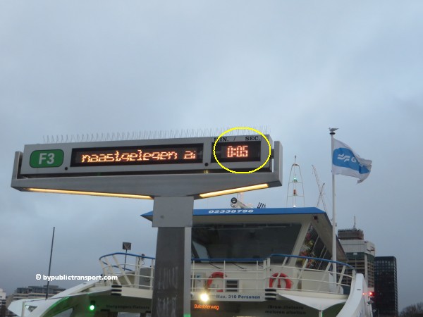
The building is easy to spot as it’s situated right next to the building of the Eye Film Institute in the North part of Amsterdam, just across Amsterdam’s waterfront at the IJ, which is at the backside of Amsterdam Centraal station. It’s therefore easy to reach by public transport. Free ferries cross the water of the IJ every 4 to 6 minutes and it only takes 5 minutes to cross the water.

Address
A’DAM Lookout
Overhoeksplein 5
1031 KS Amsterdam

More information

Other sources
This article is meant for the vast majority of travelers and covers the most important options. If you are looking for detailed information, or if you are traveling to or from less visited locations, then consult other sources:

How do I get there?
The city center of Amsterdam is quite small. Since you can visit the A’DAM LOOKOUT by a 5 minutes free ferry ride plus a 3 minutes walk, from the backside of Amsterdam Centraal station, which is in the city center of Amsterdam, most people visit the attraction simply by foot or by rented bike. Although, a bike is not necessary to visit the A’DAM LOOKOUT, as it’s just a 3 minutes walk from the ferry, you can take your bike on the ferry for free. From the Bijenkorf department store on Dam Square, the trip by foot & ferry will take 21 minutes.

A’DAM Toren has it’s own parking garage beneath the building. It is possible to park your car on the street near the A’DAM LOOKOUT. However, the area surrounding the A’DAM Toren, basically is an area for pedestrians and cyclists. Consequently, the number of parking places available on the street is limited. Taxis in The Netherlands are expensive and taxis to the A’DAM LOOKOUT have to take a detour, so the best way to visit the attraction is by foot & ferry, rented bike & ferry, or by public transport.

Public transport options
The A’DAM LOOKOUT is located just across Amsterdam’s waterfront at the IJ, which is at the backside of Amsterdam Centraal station in the city center of Amsterdam. You can visit the A’DAM LOOKOUT by a 5 minutes free ferry ride, from the backside of the station plus a 3 minutes walk. The best public transport option for you depends on your starting point (e.g. hotel or railway station). You can reach Amsterdam Centraal station from 9 other railway stations in the Amsterdam area and also from Amsterdam Airport Schiphol.

The map below shows the main tram and metro stops near the A’DAM LOOKOUT.

(Click to open a large map in new tab)
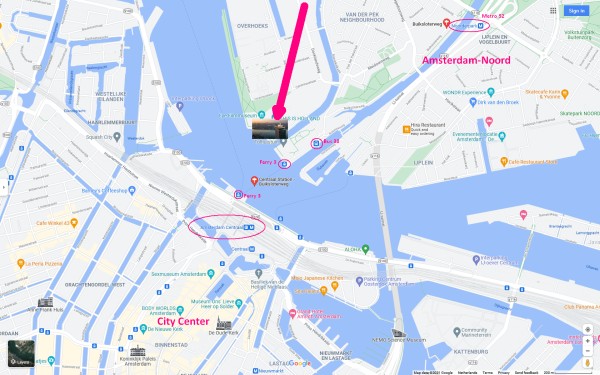
adam lookout amsterdam tram metro stops nearby 600 x 375

The metro/tram map below, might help you to find the best options for you.

(Click to open a large map in new tab)
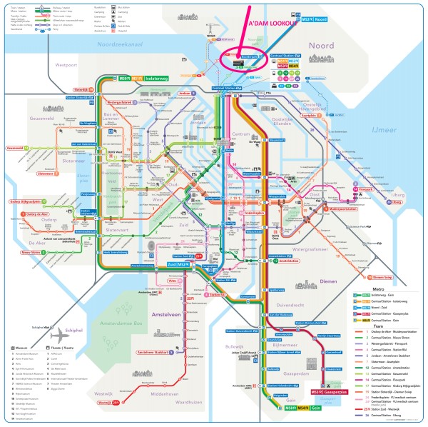
amsterdam metro tram map plan adam lookout 600 X 598

Best options
T = Tram, M = Metro, B = Bus, F = Ferry, > = Transfer

From Number Stop Remarks
Amsterdam Centraal station F3 Buiksloterweg + 3 minutes walk
Amsterdam Zuid station M52 > F3 Buiksloterweg Transfer to ferry at Amsterdam Centraal station
Amsterdam RAI station M52 > F3 Buiksloterweg Transfer to ferry at Amsterdam Centraal station
Amsterdam Amstel station M51, M53, M52 > F3 Buiksloterweg Transfer to ferry at Amsterdam Centraal station
Amsterdam Sloterdijk station Train to Amsterdam Centraal station > F3 Buiksloterweg Transfer to ferry at Amsterdam Centraal station
Amsterdam Lelylaan station Train to Amsterdam Centraal station > F3 Buiksloterweg Transfer to ferry at Amsterdam Centraal station
Duivendrecht station M50, M54 > F3 Buiksloterweg Transfer to ferry at Amsterdam Centraal station
Amsterdam Bijlmer ArenA station M50, M54 > F3 Buiksloterweg Transfer to ferry at Amsterdam Centraal station
Amsterdam Muiderpoort railway station Train to Amsterdam Centraal station > F3 Buiksloterweg Transfer to ferry at Amsterdam Centraal station
Amsterdam Noord M52 > F3 Buiksloterweg Transfer to ferry at Amsterdam Centraal station
Schiphol Airport railway station Train to Amsterdam Centraal station > F3 Buiksloterweg Transfer to ferry at Amsterdam Centraal station
More information


Entrance & ticket boot
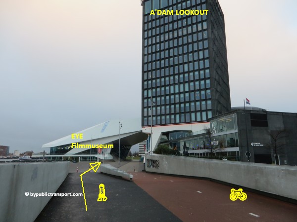
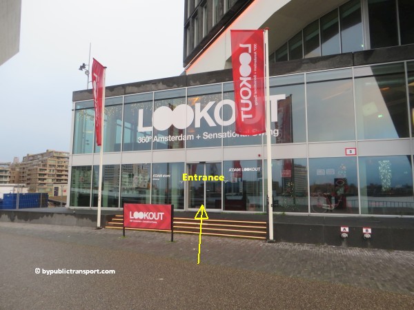
The entrance to the A’DAM LOOKOUT is at the waterfront-side of the building, just a 3 minutes walk from the ferry. The ticket office near the entrance only accepts debit- and credit card payments, no cash. It’s better to purchase tickets online and in advance. You often get a € 2,– discount per ticket, when you purchase your tickets on the website, depending on the type of ticket.

Amsterdam Centraal station
Amsterdam Centraal Station is the largest railway station in Amsterdam, both for national and international trains. It’s also an important transfer hub, as many trams, local and regional buses and metros stop here. Amsterdam Centraal station is often the final stop of the line. At the north side of the building, free blue-and-white ferries for pedestrians, cyclists and mopeds cross the River IJ, heading to the Amsterdam-Noord (north) borough, where the A’DAM LOOKOUT is located. At the front side of the building (the south- city center side) are the the tram platforms, the main Amsterdam tourist office, as well as some departure quays for tourist boats which cruise the city’s famous canals.

Amsterdam Centraal station was designed by Dutch architect Pierre Cuypers and opened in 1889. Cuypers’ design of the building resembled his other architectural masterpiece, the Rijksmuseum, of which the construction had begun in 1876. While Cuypers was the principal architect of the station, it is believed that he focused mostly on the decoration of the station building and left the structural design to railway engineers. It features a Gothic, Renaissance Revival station building and a cast iron platform roof spanning approximately 40 meters. Since 1997, the station building, underground passages, metro station, and the surrounding area have been undergoing major reconstruction and renovation works to accommodate the North-South Line metro route, which was opened on 22 July 2018.

Most visitors to the A’DAM LOOKOUT will travel via Amsterdam Centraal station, as Central station is is just a free 5 minutes ferry ride plus 3 minutes walk away.

Trams to Centraal Station
There are two major tram platforms at Stationsplein, near the station’s main entrance at the south/city center side of Amsterdam.

A. Tram 4, 14, 24 and 26 stop at platform A, east side. These trams (except tram 26) pas the city center of Amsterdam, crossing Dam Square and passing the Bijenkorf department store.

B. Tram 2, 12, 13 and 17 stop at platform B, west side. Those trams pass the city center and Dam Square at the west side of the square, behind the Royal Palace Amsterdam.

Walking route from two tram platforms.
As the two tram platforms are at the at the south/city center side of Amsterdam, you have to cross the station building to the north side of the building. There are 2 ways to do this:

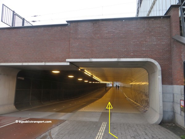
Underpass outside
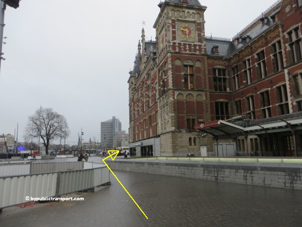
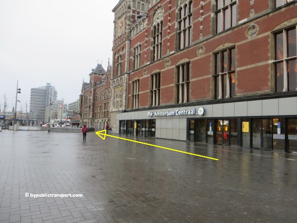
If you just want to go to the other side of the building fast and easily, without going inside the busy station hall, just follow the front of the building to the left/west side. At the west side of the building, there’s a an underpass for pedestrians and cyclists, leading to the waterfront and ferry F3 Buiksloterweg. There’s also an underpass at the east side (near tram platform A), but using this underpass is NOT recommended and even dangerous, as this underpass is meant for busses and trams.
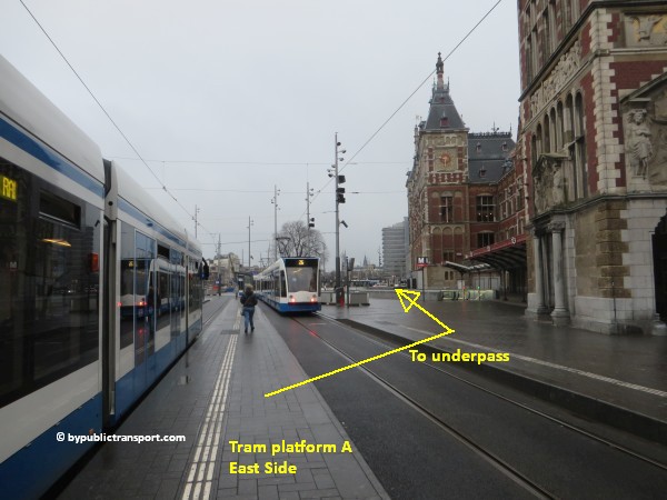
how do i get to the adam lookout in amsterdam by public transport 01

how do i get to the adam lookout in amsterdam by public transport 02

how do i get to the adam lookout in amsterdam by public transport 03

For Platform B, it’s the same. Just follow the building to the left.
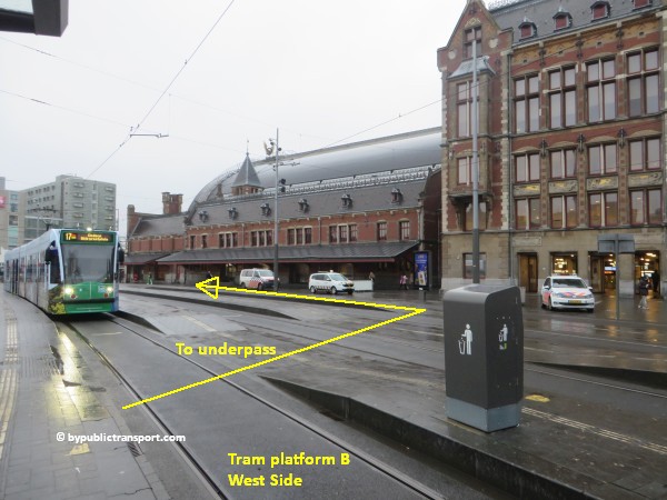
how do i get to the adam lookout in amsterdam by public transport 04

how do i get to the adam lookout in amsterdam by public transport 05

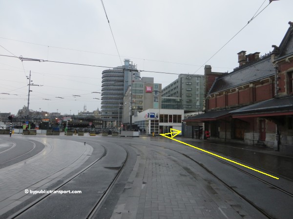
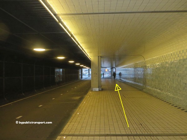
At the end of building, just in front of the white bike rental, turn right and follow the underpass to the end.
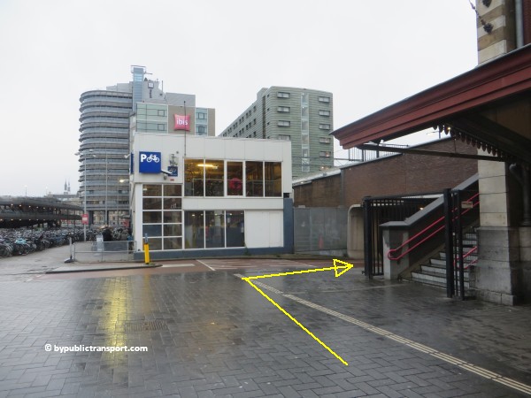
how do i get to the adam lookout in amsterdam by public transport 06

how do i get to the adam lookout in amsterdam by public transport 07

how do i get to the adam lookout in amsterdam by public transport 08

how do i get to the adam lookout in amsterdam by public transport 09

how do i get to the adam lookout in amsterdam by public transport 10

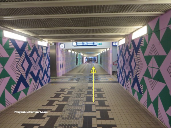
Corridors inside
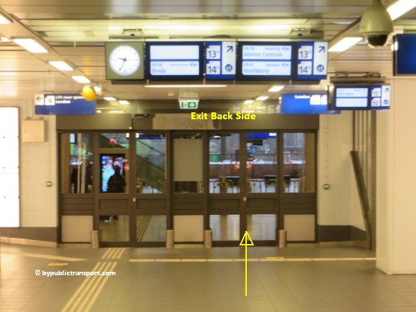
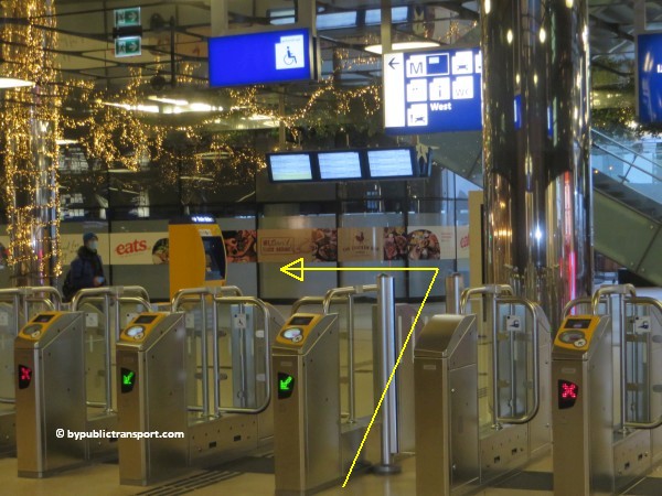
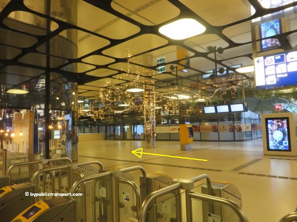
You can also cross the building by using one of the corridors on the ground floor, which cross the train platforms above. You have to check-in near the main entrance, using your OV-chipkaart, and check out again at the exit at the north side of the building near platform 13,14 and 15. No money will be charged, as you do not travel between two train stations. The public transport card is is only needed to open the turnstiles. In the corridors, there’s a nice collection of shops and bars. The corridor at the farthest right/east-side of the building, is just a no frills walkway. At the north side of the station building, there are shops and eateries as well.
how do i get to the adam lookout in amsterdam by public transport 11

Metro lines to Centraal Station
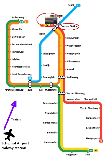
Four metro lines stop at metro station Centraal Station. Metro 53 and 54 connect the city center with the suburban residential towns of Diemen, Duivendrecht and Amsterdam-Zuidoost (the city’s southeastern borough), while metro 51 first runs south and then follows a circular route connecting the southern and western boroughs. A fourth route, metro 52, runs from Amsterdam-Zuid to the Amsterdam-Noord (north) borough via metro station Amsterdam Centraal.

Map of current Amsterdam Metro routes to A’DAM LOOKOUT via metro station Amsterdam Centraal.
amsterdam metro lines to a dam lookout via amsterdam centraal station

Metro 52
Since July 2018, metro 52 (North/Southline) runs between Amsterdam Zuid station via Amsterdam Centraal station and on to Amsterdam-Noord). For this metro, Amsterdam Centraal station is just a stop on the route. Taking the ferry is much easier, nicer and faster than taking metro 52 to Amsterdam-Noord (north), as it takes about 20 minutes to walk to the nearest metro station, named Noorderpark.

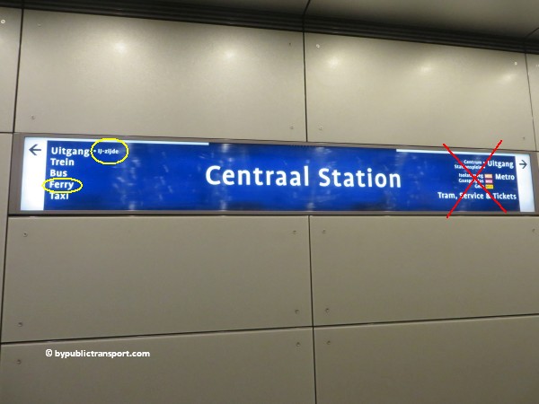
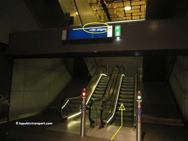
The stop at Centraal Station, exit IJ-zijde, is just a 3 minutes walk from ferry F3 to Buiksloterweg (A’DAM LOOKOUT). Make sure you travel in the right direction. Use the metro map above to determine whether you have to take metro 52 in the north or south direction. Most people will start their trip at the city center-side of Amsterdam and consequently will have too take metro 52 in the northern direction (dutch: Noord), and exit at Amsterdam Centraal.

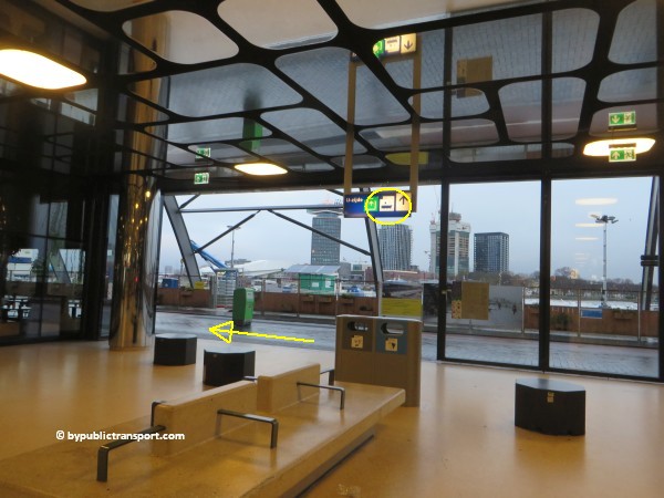
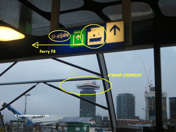
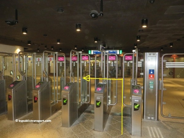
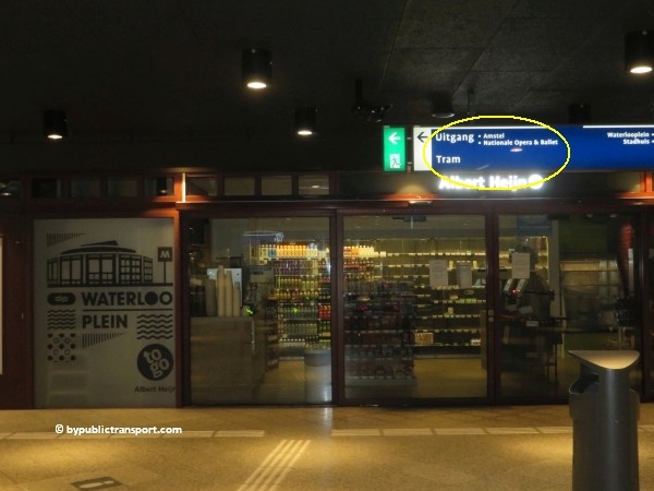
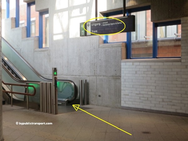
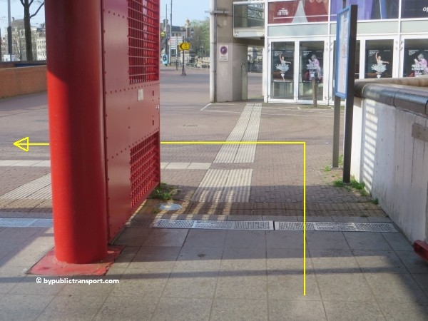
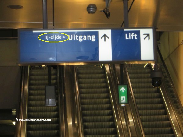
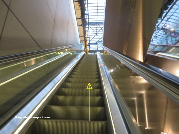
After exiting the metro at metro station Amsterdam Centraal, follow the signs Uitgang (exit) IJ-zijde / Ferry. From this exit it’s a 3 minutes walk to ferry F3 to Buiksloterweg (A’DAM LOOKOUT).
how do i get to the adam lookout in amsterdam by public transport 12

how do i get to the adam lookout in amsterdam by public transport 13

how do i get to the adam lookout in amsterdam by public transport 14

how do i get to the adam lookout in amsterdam by public transport 15

Metro (51), 53, 54
This is the old metro line (Eastline), starting at Amsterdam-Southeast (Bijlmer, Amsterdam Zuid-Oost) and heading to Amsterdam Centraal station. This is the last stop on the line. After exiting the metro at metro station Amsterdam Centraal, follow the signs Uitgang (exit) IJ-zijde / Ferry. From this exit it’s a 3 minutes walk to ferry F3 to Buiksloterweg (A’DAM LOOKOUT).

Busses
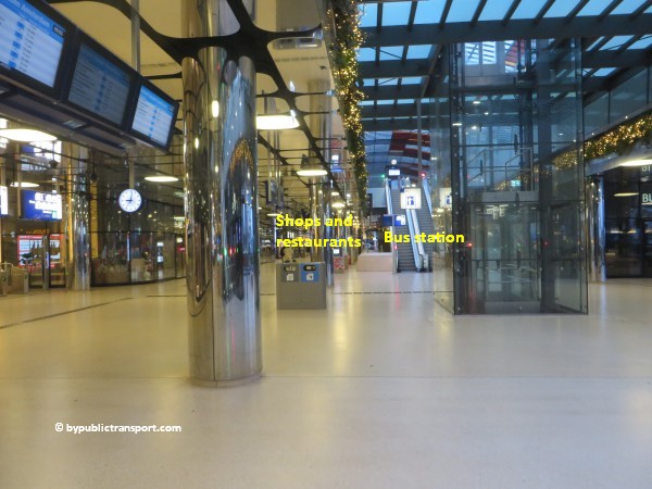
Many local and regional buses stop at the bus station attached to the station building (Bushalte CS IJzijde, Amsterdam), which is at a platform on the first floor at the north side / back of the station building, near the ferries. You can reach the ground floor by stairs, elevators and escalators.

Busses from Noord-Holland
There are frequent regional busses from several towns in the province of Noord-Holland to Amsterdam Centraal station:

From Bus Halte
De Rijp, Purmerend 305 CS IJzijde
Purmerend 306 CS IJzijde
Hoorn 314 CS IJzijde
Edam, Volendam 316 CS IJzijde
Zaandam 391 & 394 CS IJzijde


Bus 38
Bus stop Buiksloterwegveer is close to the ferry stop and the A’DAM LOOKOUT. This is a stop on the route of bus 38, which is a local bus cruising through the Amsterdam-Noord (north) borough. Bus 38 brings the inhabitants and visitors of Amsterdam-Noord (north) to/from the ferry and to/from Noord metro station. Bus 38 also stops near a couple of hotels in the north part of Amsterdam, like YOTEL Amsterdam, Bastion Hotel Amsterdam Noord, Holiday Inn Express Amsterdam, i hotel and Hotel Isis. Bus 38 does NOT stop at one of Amsterdam’s railway stations.

Walking route from the metro station to ferry F3 Buiksloterweg.
Metro station Amsterdam Centraal has exits near the front/city center side of Amsterdam Centraal station as well as an exit near the back / waterfront / IJ-side of the building. The exit at the back of the building is just a 3 minutes walk from ferry F3 to Buiksloterweg (A’DAM LOOKOUT). When you exit the metro station at the city center side, you have to cross the building as is described above for the tram platforms.

Walking route from the train platforms to ferry F3 Buiksloterweg.
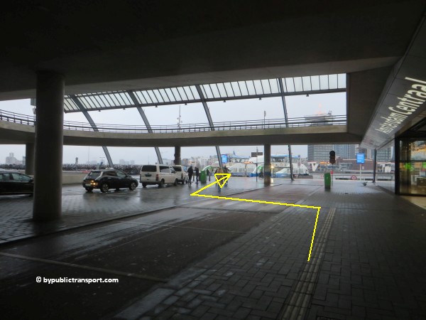
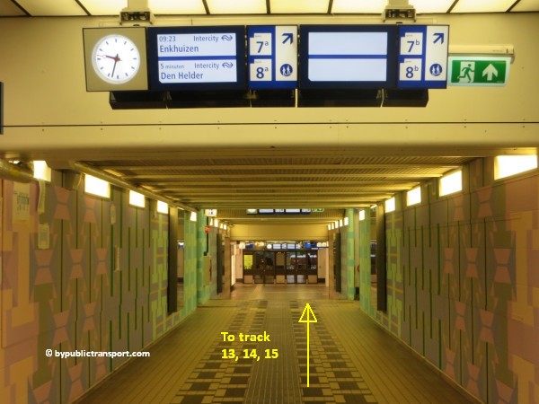
The route from the train platforms on the first floor of Amsterdam Centraal station is basically the same, as the stairs, escalators and elevators go to one of the corridors downstairs. Just go downstairs and make sure you walk in the direction of the the farthest platforms (13, 14, 15). Just outside you can check out, using your OV-chipkaart.
how do i get to the adam lookout in amsterdam by public transport 16

how do i get to the adam lookout in amsterdam by public transport 17

how do i get to the adam lookout in amsterdam by public transport 18

how do i get to the adam lookout in amsterdam by public transport 19

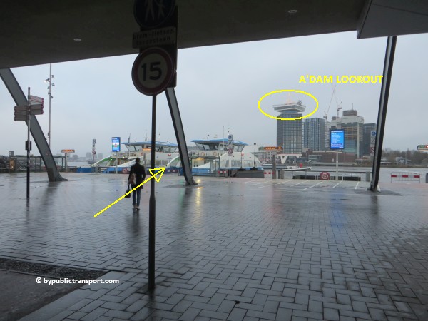
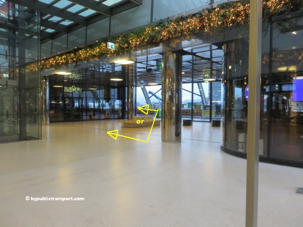
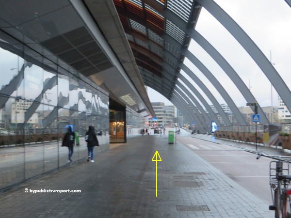
At IJ-side, you turn to the left to reach ferry F3. You can choose whether to walk outside using the sidewalk to the ferry, or inside trough the covered shopping and restaurant area.
how do i get to the adam lookout in amsterdam by public transport 20

how do i get to the adam lookout in amsterdam by public transport 21

how do i get to the adam lookout in amsterdam by public transport 22

how do i get to the adam lookout in amsterdam by public transport 23

how do i get to the adam lookout in amsterdam by public transport 24

how do i get to the adam lookout in amsterdam by public transport 25

how do i get to the adam lookout in amsterdam by public transport 26

From the ferry stop at the other side
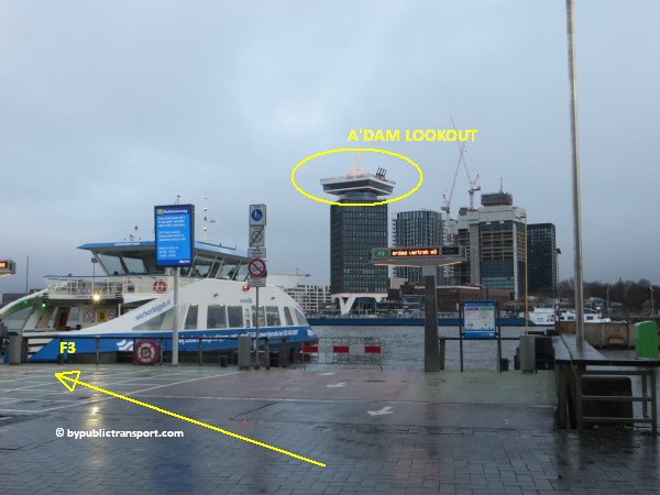
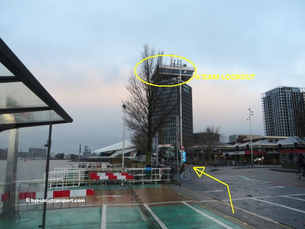
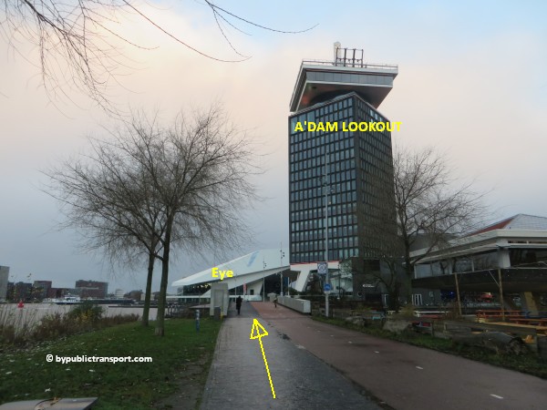
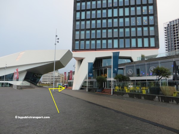
When the ferry reaches the other side, which takes 5 minutes, you’ll immediately will see which way to go as you see the A’DAM Toren and the Eye Filmmuseum left of the ferry stop. Just walk to the left and cross the bridge for bicycles and pedestrians to the entrance of the A’DAM LOOKOUT. Besides pedestrians, many bikes and scooters leave the ferry as well, so take care and make sure you walk on the side walk at the left and NOT on the bike path.
how do i get to the adam lookout in amsterdam by public transport 27

how do i get to the adam lookout in amsterdam by public transport 28

how do i get to the adam lookout in amsterdam by public transport 29

how do i get to the adam lookout in amsterdam by public transport 30

how do i get to the adam lookout in amsterdam by public transport 31


Schiphol Airport railway station
The railway station is beneath the airport. From the airport you can take a train to Amsterdam Centraal station approximately every 10 minutes, 17 minutes later you’ll arrive. After exiting the train, use the escalators or elevators to go down to one of the 3 hallways, which cross the station building. Follow the signs Uitgang (exit) IJ-zijde. These are the exits near the farthest platforms (13, 14, 15). From the exits, it’s a 2 minutes walk to ferry F3 to Buiksloterweg (A’DAM LOOKOUT). The ferry leaves approximately every 6 minutes, and the ride takes 5 minutes. So, it’s possible to travel from Schiphol Airport railway station to the A’DAM LOOKOUT within 45 minutes. Click here for further information on this route.
Enjoy your trip to the A’DAM LOOKOUT!

Last update: August 30, 2022
How do I get to the Anne Frank House Amsterdam by Public Transport?

Anne Frank House
The Anne Frank House (Dutch: Anne Frank Huis) is a museum dedicated to Jewish wartime diarist Anne Frank (12 June 1929 – February or March 1945). The building is located on one of the famous canals of Amsterdam, called the Prinsengracht, close to the Westerkerk, in the city center of Amsterdam in the Netherlands.

During World War II, Anne Frank hid from Nazi persecution with her family and four other people in some concealed rooms behind a bookcase in a 17th-century canal house, known as the Secret Annex (Dutch: Achterhuis). From June 1942, thirteen year old Anne kept a diary in which she wrote regularly, until the family’s arrest by the Gestapo in August 1944. Following their arrest, Anne and her sister, Margot, were transferred from Auschwitz to Bergen-Belsen, where they died (probably of typhus) a few months later.

Her father Otto, the only survivor of the Frank family, returned to Amsterdam after the war to find that her diary had been saved by his secretary, Miep Gies, and his efforts led to its publication in 1947. It was translated from its original Dutch version and first published in English in 1952 as The Diary of a Young Girl, and has since been translated into over 70 languages.

Ten years later the Anne Frank Foundation was established to protect the property from developers who wanted to demolish the block.

The museum opened on 3 May 1960. It preserves the hiding place, has a permanent exhibition on the life and times of Anne Frank, and has an exhibition space about all forms of persecution and discrimination. In 2013 and 2014, the museum had 1.2 million visitors and was the 3rd most visited museum in the Netherlands, after the Rijksmuseum and Van Gogh Museum.

Address
Anne Frank House
Westermarkt 20
1016 GV Amsterdam

More information

Other sources
This article is meant for the vast majority of travelers and covers the most important options. If you are looking for detailed information, or if you are traveling to or from less visited locations, then consult other sources:

How do I get there?
The city center of Amsterdam is quite small. Since the Anne Frank House is situated right in the the city center, many people visit the museum simply by foot or by rented bike. For example, a walk from Amsterdam Centraal station to the Anne Frank House would take 20 minutes and you’ll pass the busy shopping area, or if you want, the famous canal zone of Amsterdam along the way. From the Bijenkorf department store on Dam Square, it’s only a 9 minutes walk. Click here for the pictures of the walking route from Dam Square to the museum.

It is possible to park your car near the Anne Frank House. However, the number of parking places available is limited and parking your car in Amsterdam is very expensive. There are also some supervised parking garages in the area. Taxis in The Netherlands are expensive and the Anne Frank House is in a busy area, so the best way to visit the museum is by foot, rented bike, or by public transport.

Public transport options
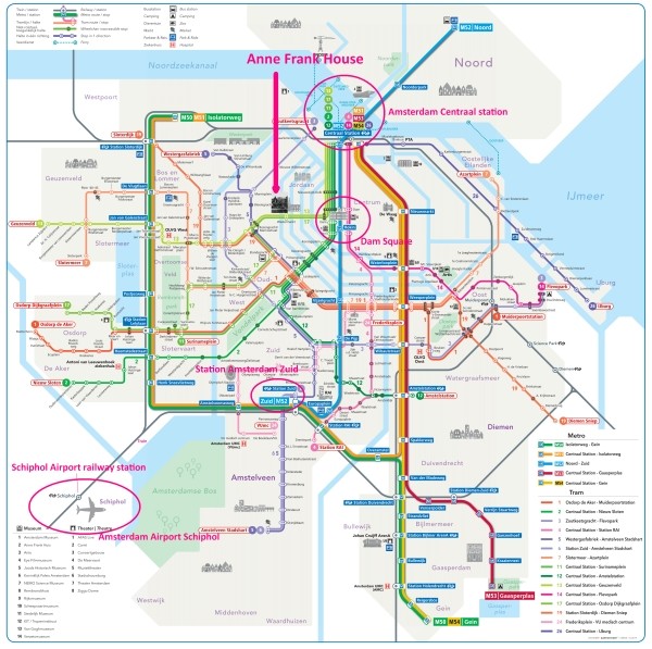
The Anne Frank House is located right in the city center of Amsterdam, in a busy area. There are many public transport options, which can make it slightly confusing. The one which is the best for you, depends on your starting point (e.g. hotel or railway station). You can reach the Anne Frank House from 9 railway stations in the Amsterdam area and also from Amsterdam Airport Schiphol. Dam Square is a nice public square. So, if you arrive anywhere near Dam Square by public transport and don’t mind to walk 10 minutes, you should be fine.

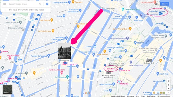
The map below shows the main tram and metro stops near the Anne Frank House.

(Click to open a large map in new tab)
anne frank house amsterdam tram metro stops nearby 600 x 338

The metro/tram map below, might help you to find the best options for you.

(Click to open a large map in new tab)
amsterdam metro tram map plan anne frank house 600 x 597

Best options
T = Tram, M = Metro, B = Bus, > = Transfer

From Number Stop Remarks
Amsterdam Centraal station T2, T12, T13, T17 Westermarkt Stops around the corner of the Anne Frank House
Amsterdam Zuid station M52 Rokin + 10 minutes walk
Amsterdam RAI station M52 Rokin + 10 minutes walk
Amsterdam Amstel station T12 Dam + 6 minutes walk
Amsterdam Sloterdijk station T19 > T13 Westermarkt Transfer at Willem de Zwijgerlaan
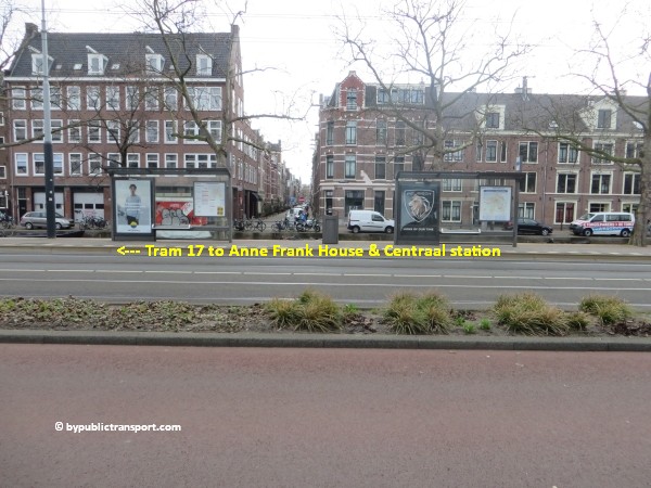
Amsterdam Lelylaan station T17 Westermarkt >Stops around the corner of the Anne Frank House
Duivendrecht station M50 > M52 Rokin Transfer at station Zuid
Amsterdam Bijlmer ArenA station M50 > M52 Rokin Transfer at station Zuid
Amsterdam Muiderpoort railway station T3 > T13 Westermarkt Transfer at De Clercqstraat
Amsterdam Noord M52 Rokin + 10 minutes walk
Schiphol Airport railway station Train > M52 Rokin Transfer at Amsterdam Zuid station
More information
Amsterdam Airport Schiphol B397 > T17 Westermarkt Transfer at Elandsgracht, or walk 11 minutes
More information


Entrance
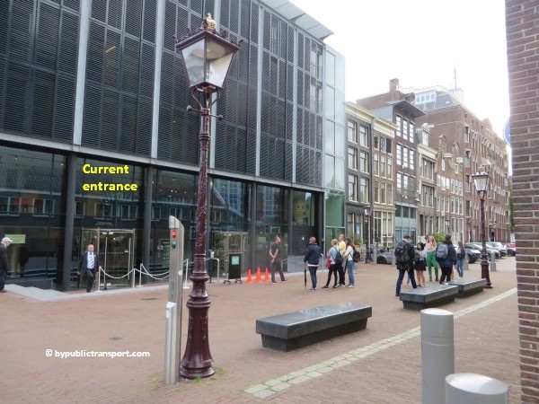
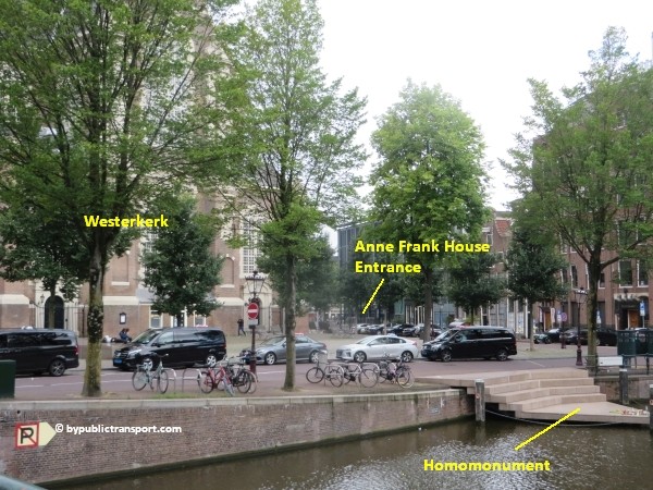
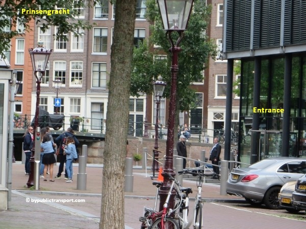
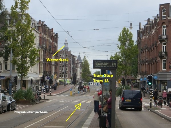
The current entrance to the museum is no longer at the original house at Prinsengracht 263. The entrance is around the corner, at Westermarkt 20, just behind the famous and easy recognizable Westerkerk chuch, and close to tram stop Westermarkt (13 + 17). At the time of writing, the Anne Frank House no longer sells tickets at a ticket boot. Tickets can only be purchased online for a specific time slot. Rescheduling of tickets or refunds are not possible.
anne frank house in amsterdam by public transport 01

anne frank house in amsterdam by public transport 02

Tram 2, 12, 13, 17
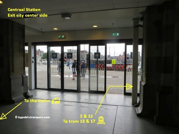
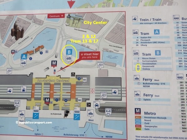
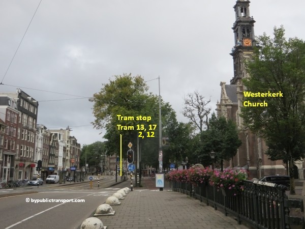
These trams leave from Centraal Station and stop just around the corner of the Anne Frank House at tram stop Westermarkt. When arriving at Amsterdam Centraal station by train, most visitors should walk in direction of train platform 1/2 to an exit at the city center side. At the center side you will find metro entrances and two tram platforms. Walk towards an exit and check out at a ticket barrier with the NS logo on it. Tram 2, 12, 13 and 17 stop on the western platform. To get there, immediately turn right when exiting the railway station at the city center side.
anne frank house in amsterdam by public transport 03

anne frank house in amsterdam by public transport 04

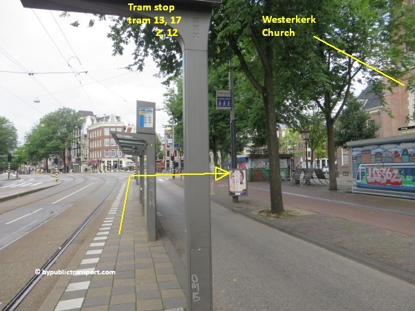
When you leave the tram at tram stop Westermarkt, just walk in direction of the Westerkerk church you see. The entrance of the Anne Frank House is just behind the church.
anne frank house in amsterdam by public transport 05


Metro 52
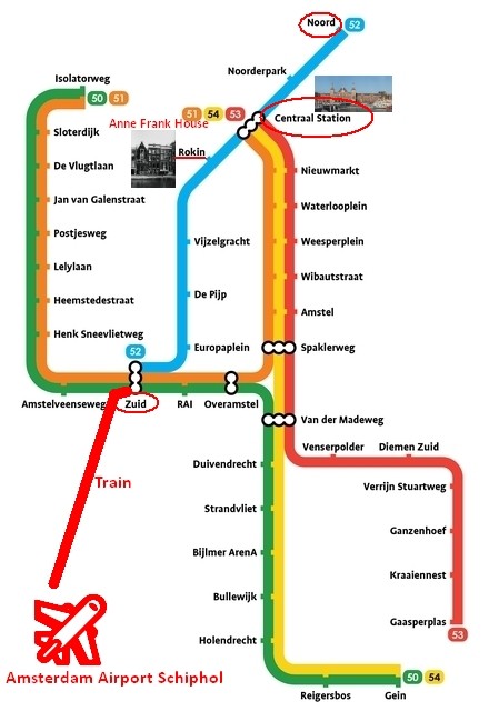
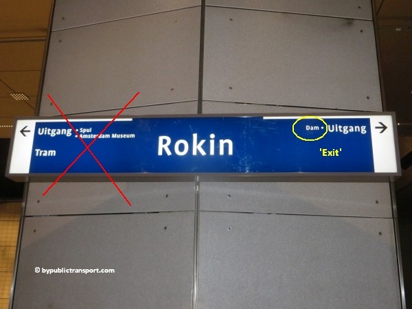
Since July 2018, metro 52 (North/Southline) runs between station Zuid and Centraal Station (and on to Amsterdam-Noord). The stop at Rokin, exit Dam, is just a 10 minutes walk from the Anne Frank House. Make sure you travel in the right direction. Use the metro map below to determine whether you have to take metro 52 in the north or south direction.
amsterdam metro map plan anne frank house

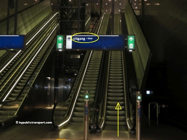
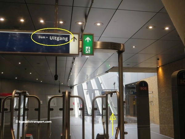
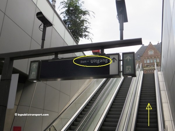
After exiting the metro train follow the signs Uitgang (exit) Dam.
anne frank house in amsterdam by public transport 06

anne frank house in amsterdam by public transport 07

anne frank house in amsterdam by public transport 08

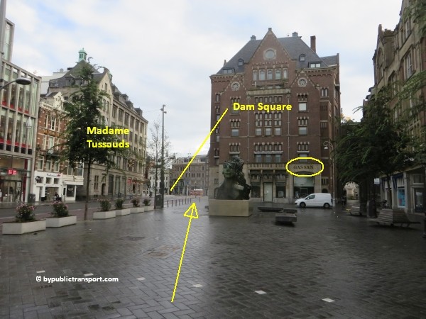
Use the 2 escalators to go upstairs and exit the station using the exit at Dam (Dam Square). As soon as you’ve left the last escalator, walk straight ahead in direction of Dam Square (Dam). You’ll probably see GASSAN Dam Square and the famous Scheltema bookstore. You’ll see Madame Tussauds Amsterdam at the other side of Rokin, at the corner of Dam Square.
anne frank house in amsterdam by public transport 09

anne frank house in amsterdam by public transport 10

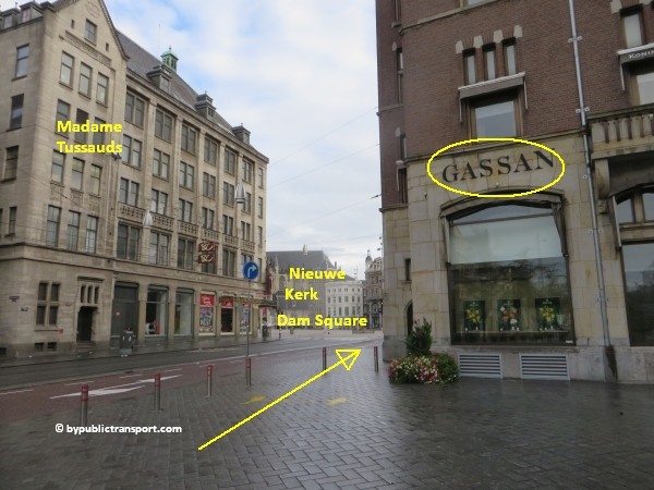
Use the pedestrian crossing next to GASSAN Dam Square to cross Rokin in direction of Madame Tussauds Amsterdam. Take your time and wait for the green pedestrian light. At busy moments cars, trams, taxis, and bicycles usually come from everywhere at this point. Cyclists in Amsterdam might ring their bicycle bells, but usually don’t stop and might kill you.
anne frank house in amsterdam by public transport 11

anne frank house in amsterdam by public transport 12

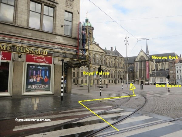
At the corner of Dam Square, at Madame Tussauds Amsterdam, you’ll see the famous Royal Palace of Amsterdam (Koninklijk Paleis or Paleis op de Dam) and the Nieuwe Kerk church. The walking route to the Anne Frank House basically starts between the Royal Palace and the church.
anne frank house in amsterdam by public transport 13

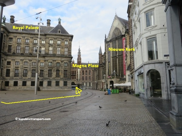
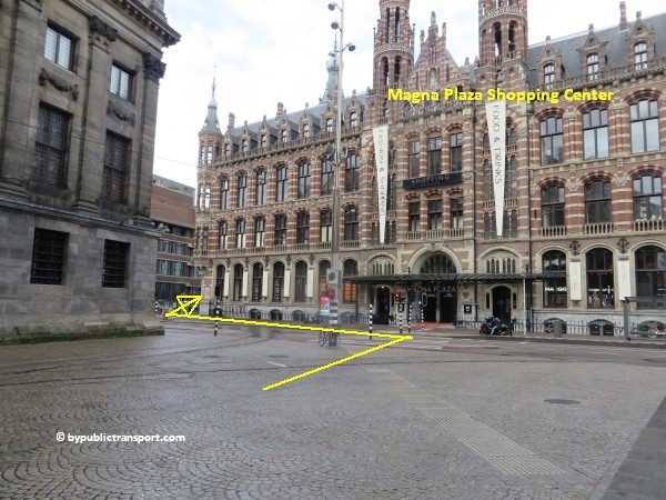
At the end of the short street between the palace and the church, use the pedestrian crossing to cross the street in the direction of the front-left corner of the monumental Magna Plaza shopping mall building. Take your time and wait for the green pedestrian light, as this street is usually very busy.
anne frank house in amsterdam by public transport 14

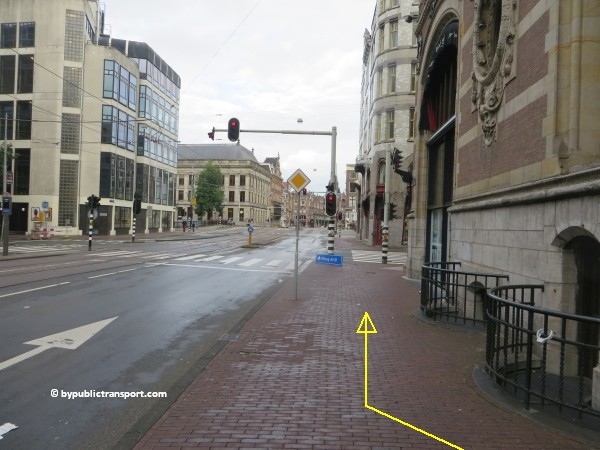
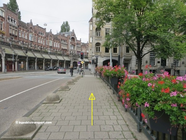
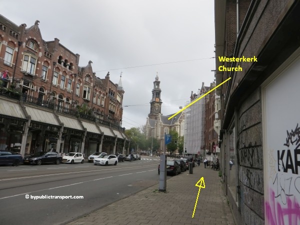
As soon as you’ve reached the other side of the street, turn around the front-left corner of Magna Plaza shopping mall building, into Raadhuisstraat. From this point it’s a 4 minutes walk to the Anne Frank House. Just keep walking straight ahead. You’ll cross the bridges of the famous Amsterdam canals: Singel, Herengracht, Keizergracht.
anne frank house in amsterdam by public transport 15

anne frank house in amsterdam by public transport 16

anne frank house in amsterdam by public transport 17

anne frank house in amsterdam by public transport 18

The entrance of the Anne Frank House is near the fourth canal (Prinsengracht), just behind the small building behind the famous and easy recognizable Westerkerk at the right side of Raadhuisstraat. The quickest way is to turn right at the church and walk around the Westerkerk church counterclockwise. You’ll see the entrance to the museum almost immediately.
anne frank house in amsterdam by public transport 19

anne frank house in amsterdam by public transport 20

Do not want to walk?
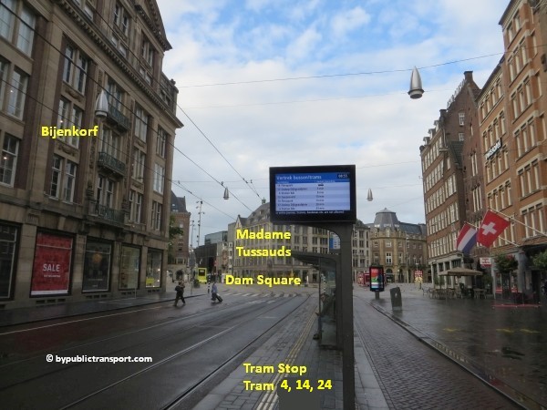
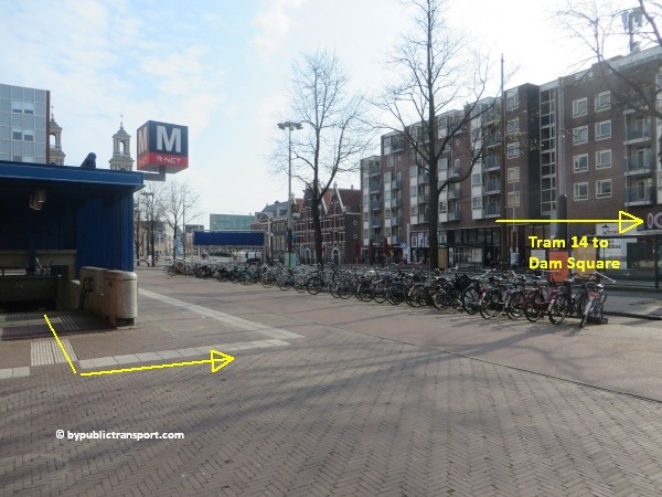
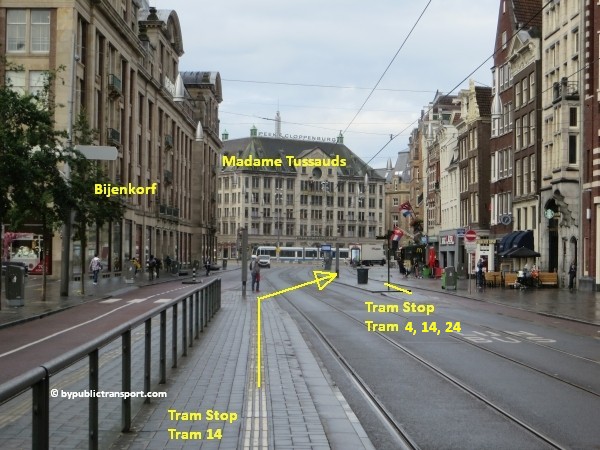
Alternatively, if you don’t want or can’t walk to the museum, you can transfer to tram 13 or 17 at Dam Square, next to the Bijenkorf department store. Make sure you take the tram in the opposite direction, in direction of Dam Square, leaving from the stop in front of Pott Change and the Tours & Tickets office. It’s only 2 stops to tram stop Westermarkt, around the corner of the Anne Frank House.
anne frank house in amsterdam by public transport 21

anne frank house in amsterdam by public transport 22
Tram 3
Tram 3 circles within the old part of Amsterdam, but outside the city center and canal area, passing the city center and the Anne Frank House at the west side. You can take this tram for example, if your starting point is near Amsterdam Muiderpoort railway station in the old east part of Amsterdam. Transfer to tram 13 at tram stop De Clerqstraat.
anne frank house in amsterdam by public transport 23

Tram 3 also stops just in front of exit Ceintuurbaan of De Pijp metro station at metro line 52 (North/Southline), so transferring here to metro 52, direction North (Noord)is also a good option. Exit the metro train at metro station Rokin, Uitgang (Exit) Dam. Click here for further information on this route.
Metro (51), 53, 54
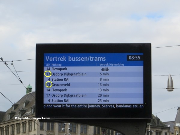
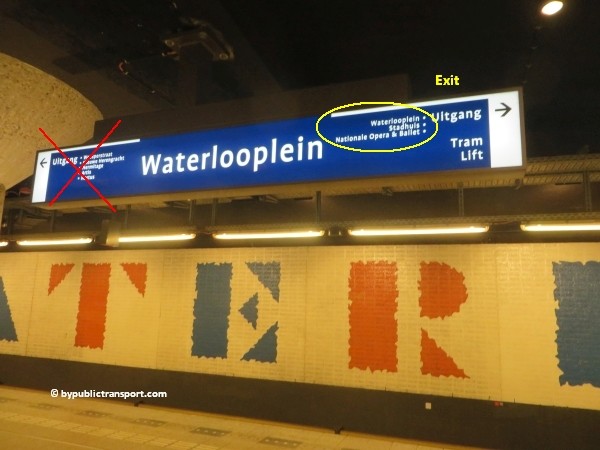
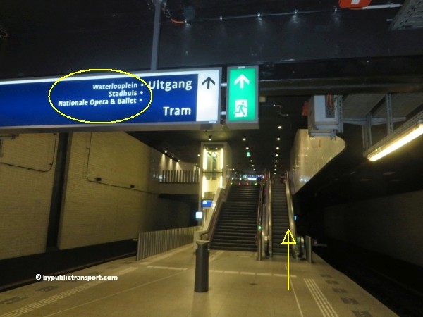
This is the old metro line (Eastline), starting at Amsterdam-Southeast (Bijlmer, Amsterdam Zuid-Oost) and heading to Amsterdam Centraal. You can still take all 3 metros and transfer to tram 14, just outside metro stop Waterlooplein, exit Waterlooplein/Stadhuis/Nationale Opera & Ballet.
anne frank house in amsterdam by public transport 24

anne frank house in amsterdam by public transport 25

anne frank house in amsterdam by public transport 26

anne frank house in amsterdam by public transport 27

anne frank house in amsterdam by public transport 28

anne frank house in amsterdam by public transport 29

anne frank house in amsterdam by public transport 29

anne frank house in amsterdam by public transport 30

Get off the tram at tram stop Dam. From this tram stop it’s an 11 minutes walk to the Anne Frank House.

Do not want to walk?
Alternatively, if you don’t want or can’t walk to the museum, you can transfer to tram 13 or 17 at Dam Square, next to the Bijenkorf department store. Make sure you take the tram in direction of Dam Square, leaving from the stop in front of Pott Change and Tours & Tickets.
It’s only 2 stops to tram stop Westermarkt, around the corner of the Anne Frank House.
anne frank house in amsterdam by public transport 31


Schiphol Airport railway station
The railway station is beneath the airport. Every 6 minutes, you can take a train to Amsterdam Zuid station. 7 minutes later you’ll arrive. From station Zuid, you can take metro 52 (also every 6 minutes) and exit 8 minutes later at Rokin, exit Dam. From Rokin, it’s an 10 minutes walk to the Anne Frank House. So, it’s possible to travel from Schiphol Airport railway station to the Anne Frank House in about half an hour. Click here for further information on this route.

Amsterdam Airport Schiphol
The Amsterdam Airport Express is a fast and easy way to travel by bus between Amsterdam Airport Schiphol and the center of Amsterdam. Every 7.5 minutes bus line 397 departs from bus stops B15-19 at Schiphol. The bus brings you to Busstation Elandsgracht, Amsterdam. Outside the bus station, near the canal opposite the Esso gas station, you can transfer to tram 17, which stops just around the corner of the Anne Frank House at tram stop Westermarkt. You can also go on foot, it’s only an 11 minutes walk.
anne frank house in amsterdam by public transport 32


‘We cannot change what happened anymore. The only thing we can do is to learn from the past and to realize what discrimination and persecution of innocent people means.’
– Otto Frank –

Last update: May 9, 2021

How do I get to the Moco Museum Amsterdam by Public Transport?

Moco Museum
The Moco Museum (Modern Contemporary Museum Amsterdam) is an independent museum located in Amsterdam, the Netherlands, dedicated to exhibiting modern and contemporary art. The museum was founded with the mission of attracting broader and younger audiences, and of making art accessible to the public. With artists like Banksy, Andy Warhol and Roy Lichtenstein, Moco Museum offers visitors a collection of subversive art in which irony and humor are used to reflect on modern society.

Moco Museum is situated on Museumplein (Museum Square), in the historic Villa Alsberg, a townhouse designed in 1904 by Eduard Cuypers the nephew of Pierre Cuypers, designer of Amsterdam Central Station and the Rijksmuseum. The townhouse was one of the first privately-owned residencies on Museumplein and remained so until 1939. The Moco Museum is just a few steps away from the Rijksmuseum, the Van Gogh Museum and Stedelijk Museum Amsterdam. It is therefore easy to combine your visit to the Moco Museum with a tour of the other important museums.
how do i get to the moco museum amsterdam by public transport 01

Address
Moco Museum
Honthorststraat 20 (Museumplein)
1071 DE Amsterdam

More information

Other sources
This article is meant for the vast majority of travelers and covers the most important options. If you are looking for detailed information, or if you are traveling to or from less visited locations, then consult other sources:

How do I get there?
The city center of Amsterdam is small. Since the Moco Museum is situated just a little south of the city center, many people visit the museum simply by foot or by rented bike. For example, a walk from Dam Square to the Moco Museum would take 20 minutes and you’ll pass the famous canals of Amsterdam along the way. It is possible to park your car near the Moco Museum. However, the number of parking places available is limited and parking your car in Amsterdam is very expensive. Under the Museumplein is a supervised underground parking garage. The entrance is at the side of the Concertgebouw, next to the Albert Heijn supermarket. Taxis in The Netherlands are expensive and the Moco Museum is in a busy area, so the best way to visit the museum is by foot, rented bike, or public transport.

Public transport options
The Moco Museum is located just south of the city center of Amsterdam, in a busy area. There are many public transport options, which can make it slightly confusing. The one which is the best for you, depends on your starting point (e.g. hotel or railway station). You can reach the Moco Museum from 9 railway stations in the Amsterdam area. Located at the Museumplein (Museum Square) are three major museums. Museumplein is a nice public square. So, if you arrive anywhere near Museumplein (Museum Square) by public transport and don’t mind to walk a couple of minutes, you should be fine.

The map below shows the main tram and metro stops near the Moco Museum.

(Click to open a large map in new tab)
moco museum amsterdam tram metro stops nearby 600 x 323

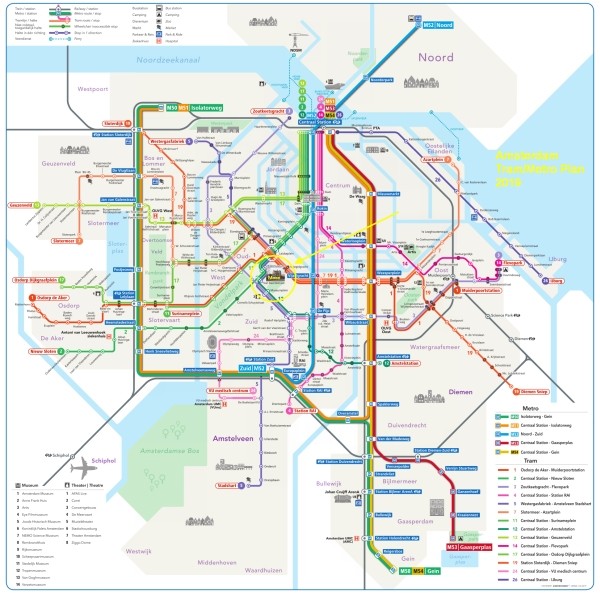
The metro/tram map below, might help you to find the best options for you.

(Click to open a large map in new tab)
amsterdam metro tram map plan moco museum 600 x 596

Best options
T = Tram, M = Metro, B = Bus, > = Transfer

From Number Stop Remarks
Amsterdam Centraal station T2 or T12 Van Baerlestraat Stops around the corner of the Moco Museum
Amsterdam Amstel station T12 Van Baerlestraat Stops around the corner of the Moco Museum
Amsterdam Sloterdijk station T19 Spiegelgracht + 5 minutes walk
Amsterdam Lelylaan station T1 Spiegelgracht + 5 minutes walk
Amsterdam Zuid station M52 Vijzelgracht + 8 minutes walk
Amsterdam RAI station M52 Vijzelgracht + 8 minutes walk
Duivendrecht station M50 > M52 Vijzelgracht Transfer at station Zuid
Amsterdam Bijlmer ArenA station M50 > M52 Vijzelgracht Transfer at station Zuid
Amsterdam Muiderpoort railway station T1 Spiegelgracht + 5 minutes walk
Amsterdam Noord M52 Vijzelgracht + 8 minutes walk
Amsterdam Airport Schiphol B397 Rijksmuseum Stops next to Museumplein (Museum Square)
Schiphol Airport railway station Train > M52 Vijzelgracht + 8 minutes walk
More information


Entrances
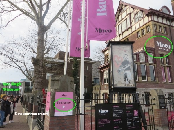
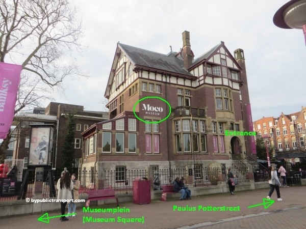
Moco Museum is situated on Museumplein (Museum Square). The entrance is just a few steps from the square at the walkway leading to Paulus Potterstraat. To avoid the lines and save time, you can make your reservations for the Moco Museum online and avoid waiting in a queue.

how do i get to the moco museum amsterdam by public transport 02


Metro 52
Since July 2018, metro 52 (North/Southline) runs between station Zuid and Centraal Station (and on to Amsterdam-Noord). The metro stop at Vijzelgracht, exit Vijzelgracht, is just an 8 minutes walk from the Moco Museum. Make sure you travel in the right direction. Use the metro map below to determine whether you have to take metro 52 in the north or south direction.
amsterdam metro map plan moco museum

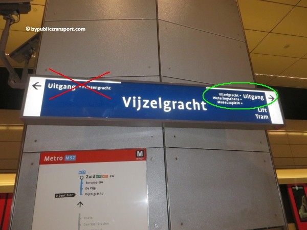
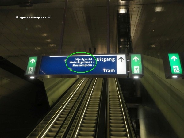
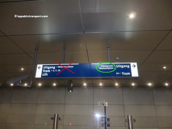
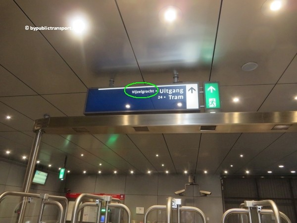
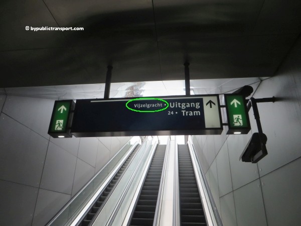
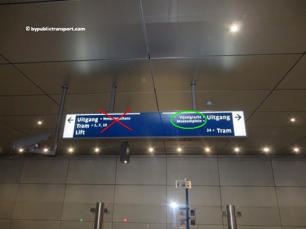
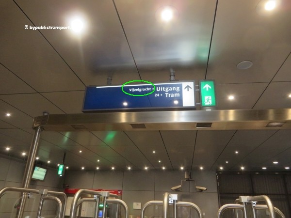
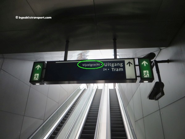
After exiting the metro train follow the signs Uitgang (exit) Vijzelgracht / Museumplein (Museum Square).
how do i get to the moco museum amsterdam by public transport 03

how do i get to the moco museum amsterdam by public transport 04

how do i get to the moco museum amsterdam by public transport 05

how do i get to the moco museum amsterdam by public transport 06

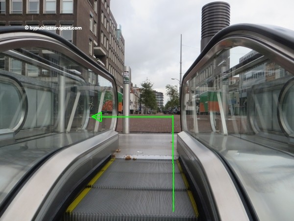
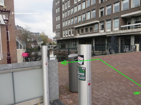
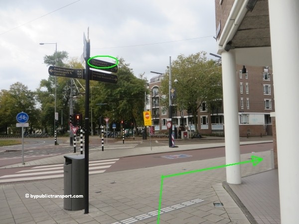
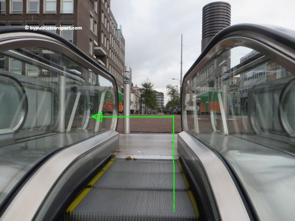
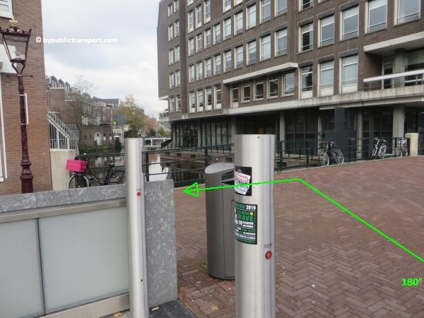
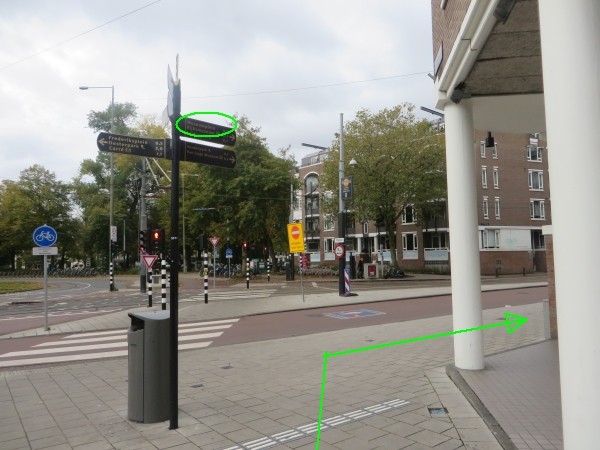
Use the 2 escalators to go upstairs and exit the station. As soon as you’ve left the last escalator, turn to the left and make a 180 degree turn. Walk to the corner at Weteringschans (only 30 meters). At the corner, turn to to the right. There’s a signpost pointing to the Museumplein (Museum Square) at the corner.
how do i get to the moco museum amsterdam by public transport 07

how do i get to the moco museum amsterdam by public transport 08

how do i get to the moco museum amsterdam by public transport 09

how do i get to the moco museum amsterdam by public transport 10

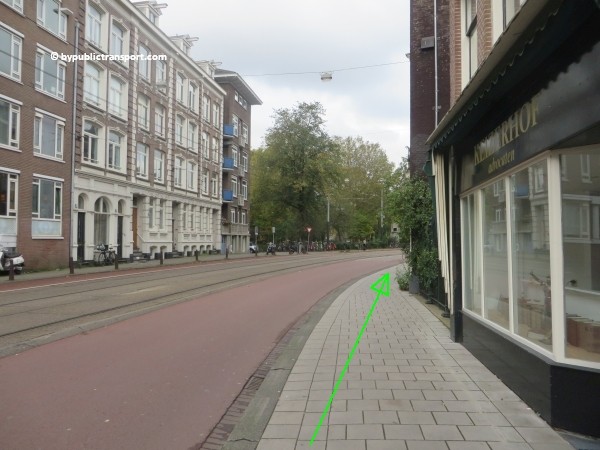
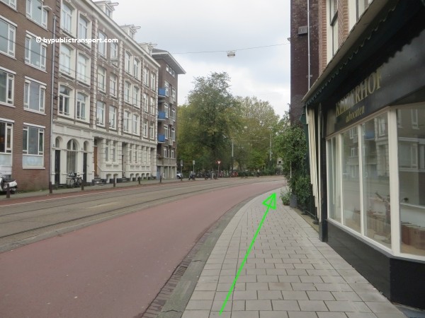
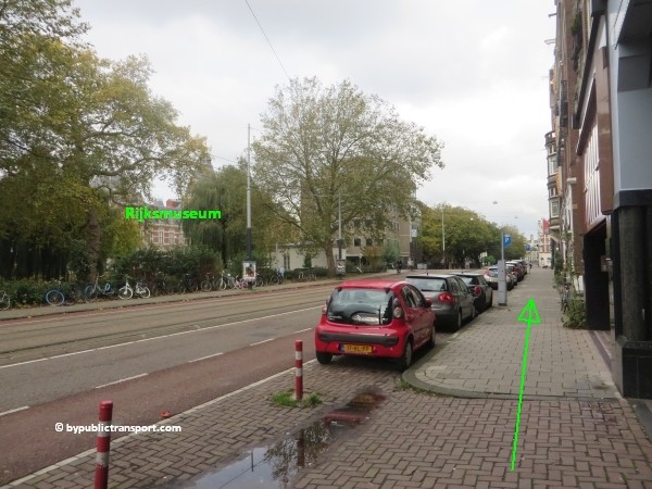
Now follow the Weteringschans to the tram stop Spiegelgracht. When you look to the left at Weteringschans, you might see the Rijksmuseum. Museumplein (Museum Square) and the Moco Museum is just behind the Rijksmuseum. Use the pedestrian crossing at the end of the tram stop to cross Weteringschans. Take care, at busy moments cars, trams, taxis, and bicycles usually come from everywhere at this point. Cyclists in Amsterdam might ring their bicycle bells, but usually don’t stop and might kill you.
how do i get to the moco museum amsterdam by public transport 11

how do i get to the moco museum amsterdam by public transport 12


how do i get to the moco museum amsterdam by public transport 13

how do i get to the moco museum amsterdam by public transport 14

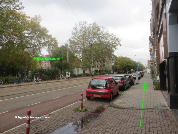
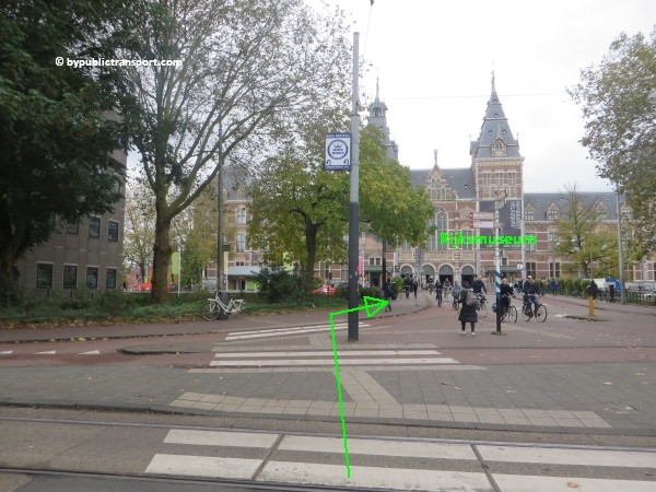
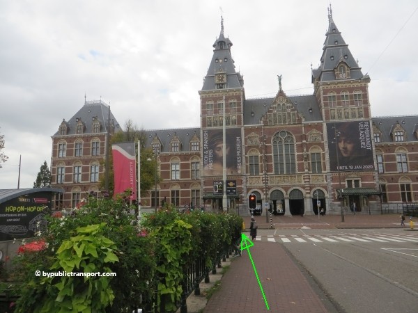
Now just follow the sidewalk to the Rijksmuseum. You’ll cross the bridge at Stadhouderskade. Use the pedestrian crossing to cross the street. Take your time and wait for the green pedestrian light, as this street is usually very busy.
how do i get to the moco museum amsterdam by public transport 15

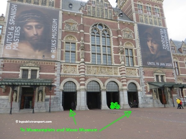
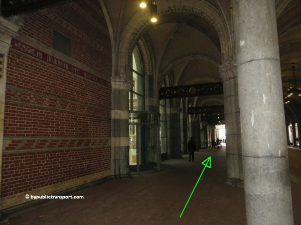
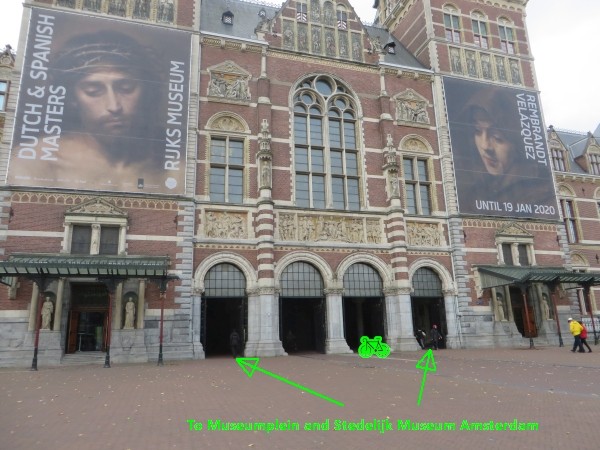
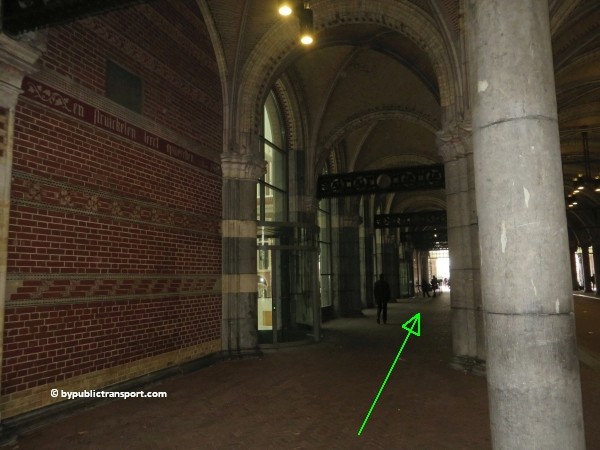
As soon as you’ve reached the other side, walk trough the arcade of the Rijksmuseum to the Museumplein (Museum Square) at the south side of the museum.
how do i get to the moco museum amsterdam by public transport 16

how do i get to the moco museum amsterdam by public transport 17

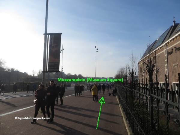
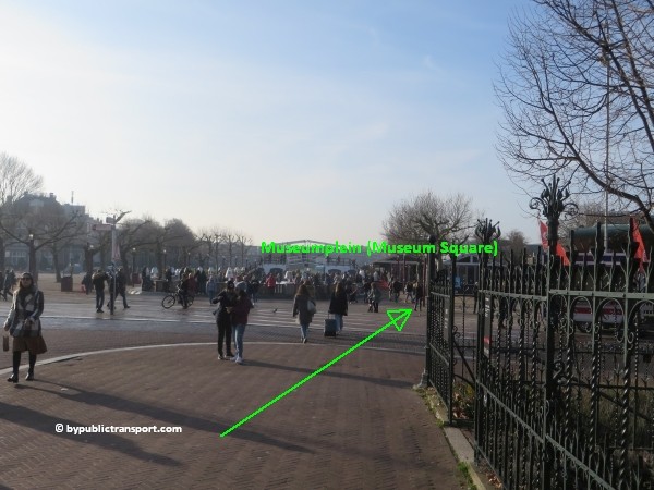
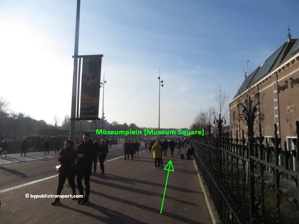
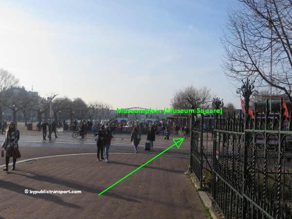
During the cold months of the year you might see an artificial skating rink in the middle of Museumplein (Museum Square). Keep walking straight ahead at the right side of the square.
how do i get to the moco museum amsterdam by public transport 18

how do i get to the moco museum amsterdam by public transport 19

how do i get to the moco museum amsterdam by public transport 20

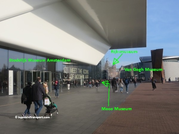
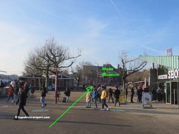
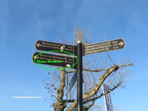
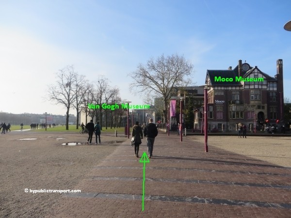
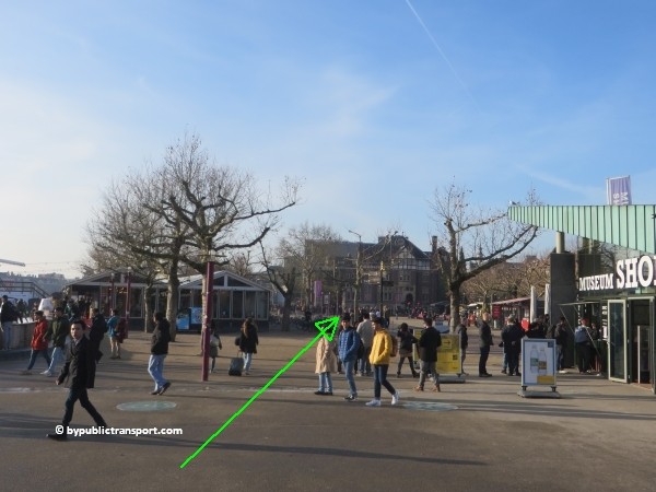
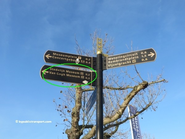
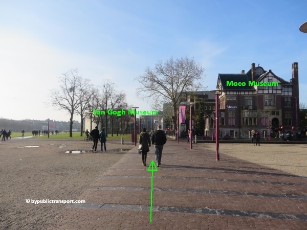
To make sure you walk in the right direction, take a look at the green signpost, pointing to the Stedelijk Museum and Van Gogh Museum. The Moco Museum is in the same direction. Follow the walkway and keep walking straight ahead for 2 minutes. The Moco Museum is the first museum in the row. Next are the the Van Gogh Museum and the Stedelijk Museum Amsterdam. The entrance of the Moco Museum is just off the square.
how do i get to the moco museum amsterdam by public transport 21

how do i get to the moco museum amsterdam by public transport 22

how do i get to the moco museum amsterdam by public transport 23

how do i get to the moco museum amsterdam by public transport 24

Metro (51), 53, 54
This is the old metro line (Eastline), starting at Centraal Station, and going to Amsterdam-Southeast (Bijlmer, Amsterdam Zuid-Oost). You can still take all 3 metros and transfer to tram 1, 7, 19 just outside metro stop Weesperplein. Get off at tram stop Spiegelgracht. From the tram stop it’s a 5 minutes walk to the Moco Museum.

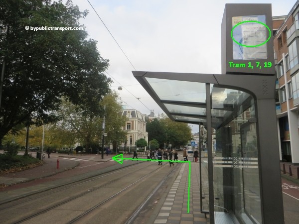
Tram 1, 7, 19
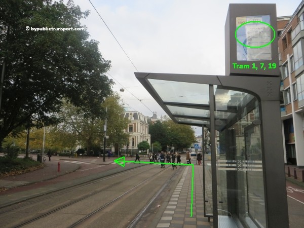
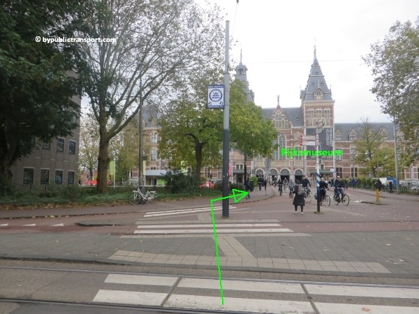
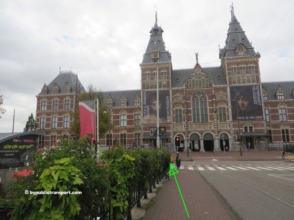
These trams pass the Rijksmuseum and the Museumplein (Museum Square) behind it at the city center (north) side. Get off at the tram and bus stop Spiegelgracht. From the tram stop it’s a 5 minutes walk to the museum.
You can find the images of this route here.


Tram 2, 5, 12
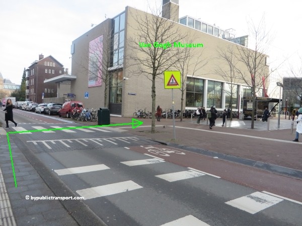
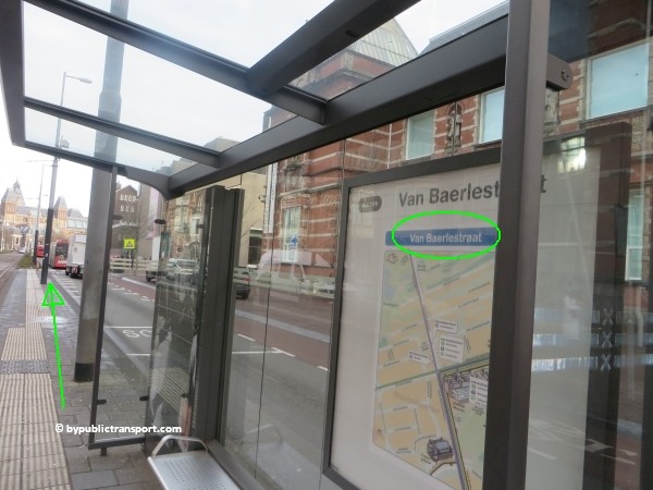
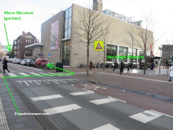
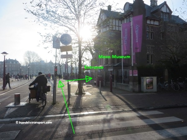
Tram 2, 5, and 12 stop at the backside of the Stedelijk Museum at Paulus Potterstraat, just around the corner of the Moco Museum. Leave the tram at tram stop Van Baerlestraat. Walking to the main entrance takes only a minute or 2. When exiting the tram, just cross the street, using the pedestrian crossing at the end of the tram stop. Follow the grayish façade of the old Van Gogh Museum (you’ll pass the group entrance). Just keep walking straight ahead for a minute. The garden of The Moco Museum is at the corner. At the corner, turn to the right (Honthorststraat) in direction of the Museumplein (Museum Square) and simply walk to the entrance.
how do i get to the moco museum amsterdam by public transport 25

how do i get to the moco museum amsterdam by public transport 26

how do i get to the moco museum amsterdam by public transport 27

[alternative] You can also get off tram 2, 5 or 12 at tram stop Rijksmuseum and approach the Moco Museum from the Rijksmuseum side, as the museum is in between the 2 tram stops.

Tram 3
Tram 3 circles within the old part of Amsterdam, but outside the city center and canal area, passing the Museumplein (Museum Square) at the Concertgebouw (south) side of the Museumplein. This tram stop is also close to the Moco Museum. You can take this tram for example, if you’ve visited the neighborhood called De Pijp (The Pipe) with it’s lively Albert Cuyp Market, just south of the city center. Tram 3 also stops just in front of exit Ceintuurbaan of De Pijp metro station at metro line 52 (North/Southline).

Get off at tram stop Museumplein. Cross the street to Museumplein (Museum Square) and simply walk to the Moco Museum at the left/west side of the square. This takes 3 minutes. Tram 5 and 12 also stop at tram stop Museumplein.
how do i get to the moco museum amsterdam by public transport 29

how do i get to the moco museum amsterdam by public transport 30

how do i get to the moco museum amsterdam by public transport 31

how do i get to the moco museum amsterdam by public transport 32

how do i get to the moco museum amsterdam by public transport 33

Amsterdam Airport Schiphol
The Amsterdam Airport Express is a fast and easy way to travel by bus between Amsterdam Airport Schiphol and the center of Amsterdam. Every 7.5 minutes bus line 397 depasrts from bus stops B15-19 at Schiphol. The bus brings you directly to bus and tram stop Rijksmuseum, next to the Museumplein (Museum Square). Walking to the entrance of the Moco Museum takes only a minute or 3.

Schiphol Airport railway station
The railway station is beneath the airport. Every 6 minutes, you can take a train to Amsterdam Zuid station. 7 minutes later you’ll arrive. From station Zuid, you can take metro 52 (also every 6 minutes) and exit 5 minutes later at metro stop Vijzelgracht. From Vijzelgracht, it’s an 8 minutes walk to the Moco Museum. So, it’s possible to travel from Schiphol Airport railway station to the Moco Museum in about half an hour. For a description of the walking route to the museum, click here.

Enjoy your trip to the Moco Museum!

Last update: January 12, 2020

How do I get to the Stedelijk Museum Amsterdam by Public Transport?

Stedelijk Museum Amsterdam
The Stedelijk Museum Amsterdam is a museum for modern art, contemporary art, and design located in Amsterdam, Netherlands. It is located at the Museum Square in the borough Amsterdam South, close to the Van Gogh Museum, the Rijksmuseum, and the Concertgebouw. In 2013, the museum had 700,000 visitors. It was the 4th most visited museum in the Netherlands, after the Rijksmuseum, Van Gogh Museum, and Anne Frank House.
how do i get to the stedelijk museum amsterdam by public transport 01

The museum has one of the world’s most important collections of modern and contemporary art. It contains almost 90,000 objects, including paintings, drawings, furniture, sculptures, and photographs. Some of the most renowned artists whose work is featured in the Stedelijk Museum include the likes of Karel Appel, Wassily Kandinsky, Kazimir Malevich, Paul Cézanne and Vincent van Gogh. In “The Stedelijk“, you can explore more than 100 years of modern art history and several key movements including De Stijl, Bauhaus, Pop, Cobra and Abstract Expressionism. The Stedelijk Museum Amsterdam was the first western European museum for modern art to collect photography. The collection includes seminal photographers of both the Dutch and international avant-garde in the interbellum period, an extensive selection of post-war Dutch photographers, artist portraits, photojournalism, and autonomous fine art photography from the 1970s onward.

The Stedelijk Museum opened on September 14, 1895 as an initiative of the local authority and private individuals. During World War II, the Stedelijk collection and that of the Amsterdam Museum were transferred for safekeeping to a bunker in the sand-hills near Santpoort. Museum staff took turns keeping watch. The old building was forced to close in January 2004 when it no longer complied with fire regulations. The Stedelijk was temporarily relocated to the Post-CS building, an old building of the Postal Service close to the Amsterdam Central Station. After further discussions about whether to relocate the contemporary art museum to an Amsterdam park, a new jury eventually awarded Benthem Crouwel Architects the renovation and construction contract for their design for the new building, referred to as “The Bathtub”. After eight years of work, the new Stedelijk opened on September 23, 2012. With the renovation and expansion, the highlights of the collection are on display in the old building in a series of changing presentations. The new wing consists of a large glassed entrance, which opens onto the Museum Square, and galleries for temporary exhibitions on the upper level and in the basement. It also houses the museum shop, restaurant and library, as well as an auditorium. The new Stedelijk has an exhibition surface area of 8,000 square meters, which is double its previous gallery space

Address
Stedelijk Museum Amsterdam
Museumplein 10
1071 DJ Amsterdam

More information

Other sources
This article is meant for the vast majority of travelers and covers the most important options. If you are looking for detailed information, or if you are traveling to or from less visited locations, then consult other sources:

How do I get there?
The city center of Amsterdam is small. Since the Stedelijk Museum Amsterdam is situated just a little south of the city center, many people visit the museum simply by foot or by rented bike. For example, a walk from Dam Square to the Stedelijk Museum Amsterdam would take 25 minutes and you’ll pass the famous canals of Amsterdam along the way. It is possible to park your car near the Stedelijk Museum Amsterdam. However, the number of parking places available is limited and parking your car in Amsterdam is very expensive. Under the Museumplein is a supervised underground parking garage. The entrance is at the side of the Concertgebouw, next to the Albert Heijn supermarket. Taxis in The Netherlands are expensive and the Stedelijk Museum Amsterdam is in a busy area, so the best way to visit the museum is by foot, rented bike, or public transport.

Public transport options
The Stedelijk Museum Amsterdam is located just south of the city center of Amsterdam, in a busy area. There are many public transport options, which can make it slightly confusing. The one which is the best for you, depends on your starting point (e.g. hotel or railway station). You can reach the Stedelijk Museum Amsterdam from 9 railway stations in the Amsterdam area. Located at the Museumplein (Museum Square) are three major museums. Museumplein is a nice public square. So, if you arrive anywhere near Museumplein (Museum Square) by public transport and don’t mind to walk a couple of minutes, you should be fine.

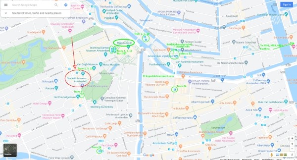
The map below shows the main tram and metro stops near the Stedelijk Museum Amsterdam.

(Click to open a large map in new tab)
stedelijk museum amsterdam tram metro stops nearby 600 x 323

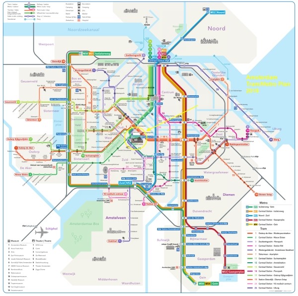
The metro/tram map below, might help you to find the best options for you.

(Click to open a large map in new tab)
amsterdam metro tram map plan stedelijk museum amsterdam 600 x 596

Best options

T = Tram, M = Metro, B = Bus, > = Transfer

From Number Stop Remarks
Amsterdam Centraal station T2 or T12 Van Baerlestraat Stops behind the Stedelijk Museum Amsterdam
Amsterdam Amstel station T12 Van Baerlestraat Stops behind the Stedelijk Museum Amsterdam
Amsterdam Sloterdijk station T19 Spiegelgracht + 6 minutes walk
Amsterdam Lelylaan station T1 Spiegelgracht + 6 minutes walk
Amsterdam Zuid station M52 Vijzelgracht + 9 minutes walk
Amsterdam RAI station M52 Vijzelgracht + 9 minutes walk
Duivendrecht station M50 > M52 Vijzelgracht Transfer at station Zuid
Amsterdam Bijlmer ArenA station M50 > M52 Vijzelgracht Transfer at station Zuid
Amsterdam Muiderpoort railway station T1 Spiegelgracht + 6 minutes walk
Amsterdam Noord M52 Vijzelgracht + 9 minutes walk
Amsterdam Airport Schiphol B397 Rijksmuseum Stops next to Museumplein (Museum Square)
Schiphol Airport railway station Train > M52 Vijzelgracht More information


Entrances
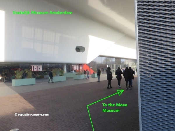
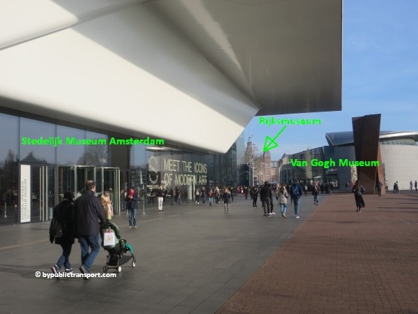
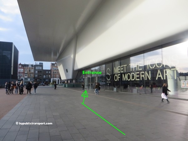
Since 2012 The Schiphol Entrance at the new Benthem Crouwel Wing (referred to as “The Bathtub”) is the grand entrance hall of the Stedelijk Museum Amsterdam on the Museumplein side. To avoid the lines and save time, you can make your reservations for the Stedelijk Museum online and avoid waiting in a queue.

Group Entrance
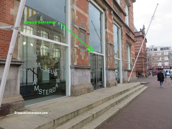
Note that the entrance for large groups is still at the brownish brick building at Paulus Potterstraat 13.
how do i get to the stedelijk museum amsterdam by public transport 02


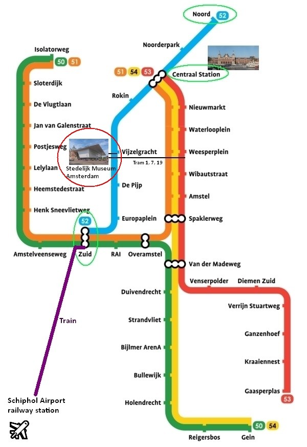
Metro 52
Since July 2018, metro 52 (North/Southline) runs between station Zuid and Centraal Station (and on to Amsterdam-Noord). The stop at Vijzelgracht, exit Vijzelgracht, is just a 9 minutes walk from the Stedelijk Museum Amsterdam. Make sure you travel in the right direction. Use the metro map below to determine whether you have to take metro 52 in the north or south direction.
amsterdam metro map plan stedelijk museum amsterdam

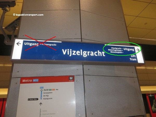
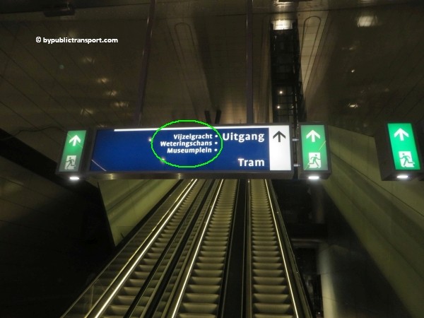
After exiting the metro train follow the signs Uitgang (exit) Vijzelgracht / Museumplein (Museum Square).
how do i get to the stedelijk museum amsterdam by public transport 03

how do i get to the stedelijk museum amsterdam by public transport 04

how do i get to the stedelijk museum amsterdam by public transport 05

how do i get to the stedelijk museum amsterdam by public transport 06

Use the 2 escalators to go upstairs and exit the station. As soon as you’ve left the last escalator, turn to the left and make a 180 degree turn. Walk to the corner at Weteringschans (only 30 meters). At the corner, turn to to the right. There’s a signpost pointing to the Museumplein (Museum Square) at the corner.
how do i get to the stedelijk museum amsterdam by public transport 07

how do i get to the stedelijk museum amsterdam by public transport 08

how do i get to the stedelijk museum amsterdam by public transport 09

how do i get to the stedelijk museum amsterdam by public transport 10

Now follow the Weteringschans to the tram stop Spiegelgracht. When you look to the left at Weteringschans, you might see the Rijksmuseum. Museumplein (Museum Square) and the Stedelijk Museum Amsterdam is just behind the Rijksmuseum. Use the pedestrian crossing at the end of the tram stop to cross Weteringschans. Take care, at busy moments cars, trams, taxis, and bicycles usually come from everywhere at this point. Cyclists in Amsterdam might ring their bicycle bells, but usually don’t stop and might kill you.
how do i get to the stedelijk museum amsterdam by public transport 11

how do i get to the stedelijk museum amsterdam by public transport 12

how do i get to the stedelijk museum amsterdam by public transport 13

how do i get to the stedelijk museum amsterdam by public transport 14

Now just follow the sidewalk to the Rijksmuseum. You’ll cross the bridge at Stadhouderskade. Use the pedestrian crossing to cross the street. Take your time and wait for the green pedestrian light, as this street is usually very busy.
how do i get to the stedelijk museum amsterdam by public transport 15

As soon as you’ve reached the other side, walk trough the arcade of the Rijksmuseum to the Museumplein (Museum Square) at the south side of the museum.
how do i get to the stedelijk museum amsterdam by public transport 16

how do i get to the stedelijk museum amsterdam by public transport 17

During the cold months of the year you might see an artificial skating rink in the middle of Museumplein (Museum Square). Keep walking straight ahead at the right side of the square.
how do i get to the stedelijk museum amsterdam by public transport 18

how do i get to the stedelijk museum amsterdam by public transport 19

how do i get to the stedelijk museum amsterdam by public transport 20

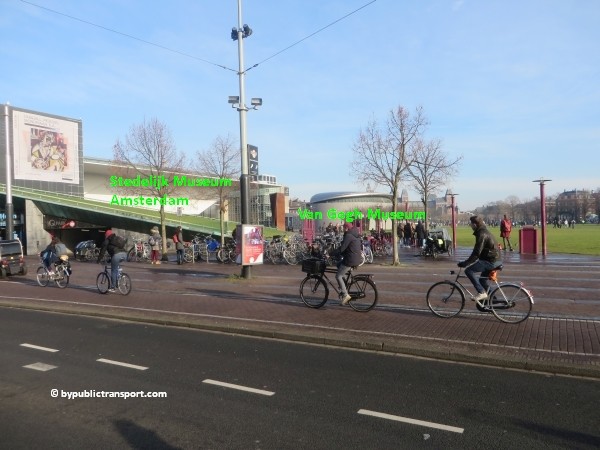
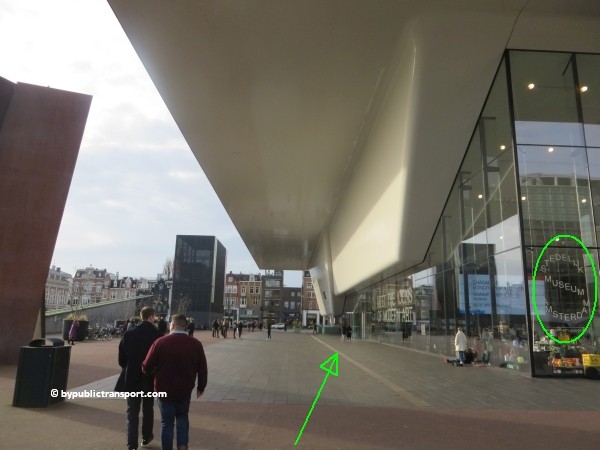
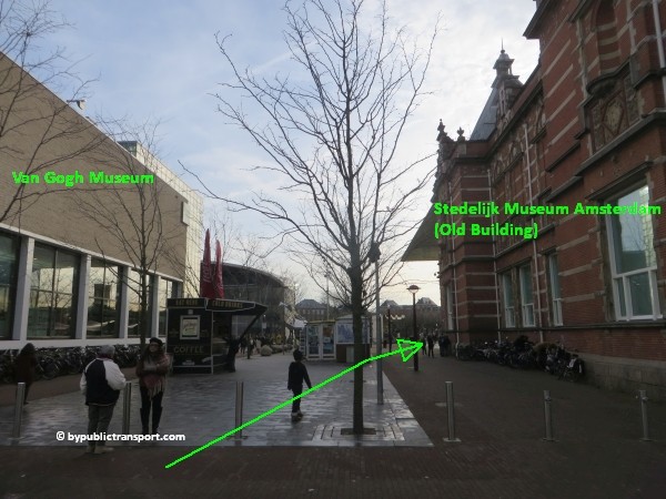
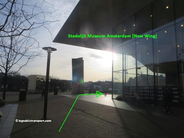
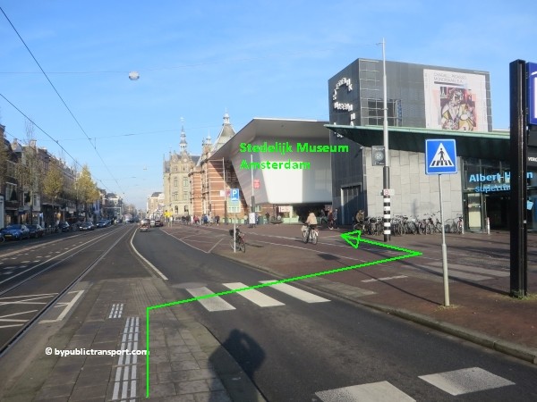
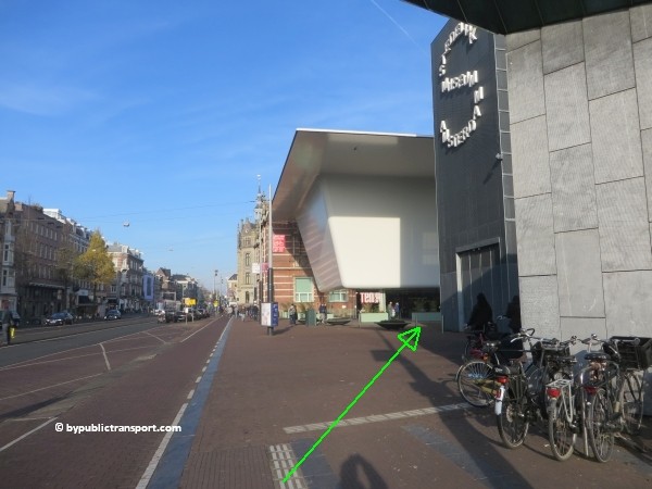
To make sure you walk in the right direction, take a look at the green signpost. Follow the walkway and keep walking straight ahead for 3 minutes. You’ll pass the independent Moco Museum and the Van Gogh Museum at your right side. Keep walking straight ahead, and follow the walkway between the 2 buildings of the Van Gogh Museum. The Stedelijk Museum Amsterdam is just behind the Van Gogh Museum. The glassed entrance of The Stedelijk is at the right side.
how do i get to the stedelijk museum amsterdam by public transport 21

how do i get to the stedelijk museum amsterdam by public transport 22

how do i get to the stedelijk museum amsterdam by public transport 23

how do i get to the stedelijk museum amsterdam by public transport 24

Metro (51), 53, 54
This is the old metro line (Eastline), starting at Centraal Station, and going to Amsterdam-Southeast (Bijlmer, Amsterdam Zuid-Oost). You can still take all 3 metros and transfer to tram 1, 7, 19 just outside metro stop Weesperplein. Get off at tram stop Spiegelgracht. From the tram stop it’s a 5 minutes walk to the Stedelijk Museum Amsterdam.

Tram 1, 7, 19
These trams pass the Rijksmuseum and the Museumplein (Museum Square) behind it at the city center (north) side. Get off at the tram and bus stop Spiegelgracht. From the tram stop it’s a 6 minutes walk to the museum.
You can find the images of this route HERE.


Tram 2, 5, 12
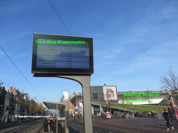
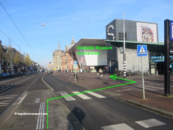
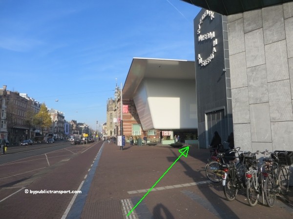
Tram 2, 5, and 12 stop at the backside of the museum at Paulus Potterstraat 13, near the group entrance. This is the closest tram stop near the Stedelijk Museum Amsterdam. Leave the tram at tram stop Van Baerlestraat. Walking to the main entrance takes only a minute or 2. When exiting the tram, just cross the street, using the pedestrian crossing at the end of the tram stop. Follow the red-brown facade of the old Stedelijk Museum to the left. At the corner, turn to the right (Willem Zandbergplein) and simply walk to the main entrance at the other side of the building.
how do i get to the stedelijk museum amsterdam by public transport 25

how do i get to the stedelijk museum amsterdam by public transport 26

how do i get to the stedelijk museum amsterdam by public transport 27

how do i get to the stedelijk museum amsterdam by public transport 28

Tram 3
Tram 3 circles within the old part of Amsterdam, but outside the city center and canal area, passing the Museumplein (Museum Square) at the Concertgebouw (south) side of the Museumplein. This tram stop is close to the Stedelijk Museum Amsterdam. You can take this tram for example, if you’ve visited the neighborhood called De Pijp (The Pipe) with it’s lively Albert Cuyp Market, just south of the city center. Tram 3 also stops just in front of exit Ceintuurbaan of De Pijp metro station at metro line 52 (North/Southline).

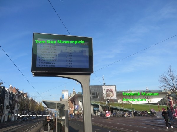
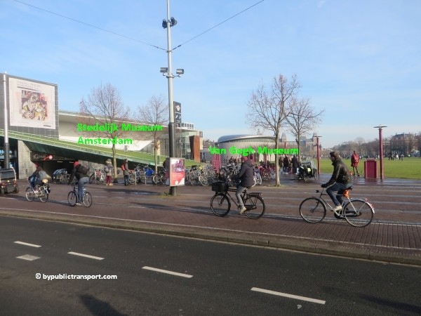
Get off at tram stop Museumplein. Cross the street to Museumplein (Museum Square) and simply walk to the Stedelijk Museum Amsterdam at the left/west side of the square. This takes 2 minutes. Tram 5 and 12 also stop at tram stop Museumplein.
how do i get to the stedelijk museum amsterdam by public transport 29

how do i get to the stedelijk museum amsterdam by public transport 30

how do i get to the stedelijk museum amsterdam by public transport 31

how do i get to the stedelijk museum amsterdam by public transport 32

how do i get to the stedelijk museum amsterdam by public transport 33

Amsterdam Airport Schiphol
The Amsterdam Airport Express is a fast and easy way to travel by bus between Amsterdam Airport Schiphol and the center of Amsterdam. Every 7.5 minutes bus line 397 departs from bus stops B15-19 at Schiphol. The bus brings you directly to bus and tram stop Rijksmuseum, next to the Museumplein (Museum Square). Walking to the entrance takes only a minute or 3.

Schiphol Airport railway station
The railway station is beneath the airport. Every 6 minutes, you can take a train to Amsterdam Zuid station. 7 minutes later you’ll arrive. From station Zuid, you can take metro 52 (also every 6 minutes) and exit 5 minutes later at metro stop Vijzelgracht. From Vijzelgracht, it’s an 8 minutes walk to the Stedelijk Museum Amsterdam. So, it’s possible to travel from Schiphol Airport railway station to the Stedelijk Museum Amsterdam in about half an hour. For a description of the walking route to the museum, click here.

Enjoy your trip to the Stedelijk Museum Amsterdam!

Last update: December 21, 2019