How do I get to the Van Gogh Museum Amsterdam by Public Transport?

Van Gogh Museum
The Van Gogh Museum is an Dutch art museum dedicated to the works of Vincent van Gogh and his contemporaries in Amsterdam. The museum contains the largest collection of Van Gogh’s paintings and drawings in the world. The Van Gogh Museum opened on 2 June 1973. In 2017, the museum had 2.3 million visitors, and was the most visited museum in the Netherlands, and the 23rd most visited art museum in the world.

The museum consists of two buildings, the Rietveld building, designed by Gerrit Rietveld, and the Kurokawa wing, designed by Kisho Kurokawa. The Kurokawa wing is used for temporary exhibitions and the Rietveld building displays the permanent works. There you will find over 200 paintings, 400 drawings and 700 letters by the Dutch artist. Some of the most well-known pieces on display include the Van Gogh Sunflowers (1889), Almond Blossoms (1890) and The Potato Eaters (1885).

The museum also houses works by some of Van Gogh’s contemporaries, including Auguste Rodin, Claude Monet, Georges Seurat and Odilon Redon, amongst others. During your visit to the Van Gogh Museum, you’ll be able to learn about the painter’s captivating history and his influence on the development of modern art during one of the tours.

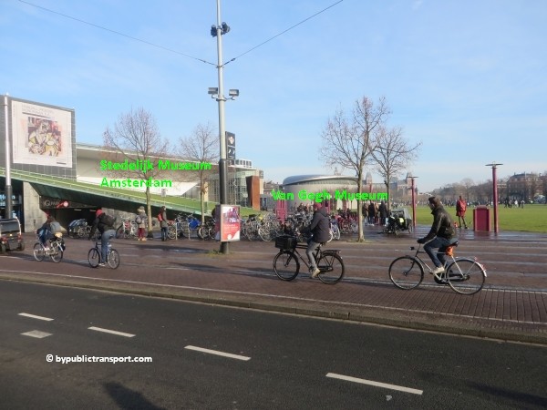
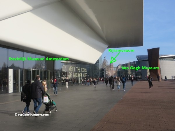
The museum is located at the Museumplein (Museum Square) in the borough Amsterdam South, just south of the city center between the Stedelijk Museum Amsterdam, the Rijksmuseum, and close to the Concertgebouw.
how do i get to the van gogh museum amsterdam by public transport 01

Address
Van Gogh Museum
Museumplein 6
1071 DJ Amsterdam

Floor plan
Download a floor plan of the Van Gogh Museum by clicking on the icon below (opens in new tab).
rijksmuseum amsterdam floorplan english pdf download button 40 x 56

More information

Other sources
This article is meant for the vast majority of travelers and covers the most important options. If you are looking for detailed information, or if you are traveling to or from less visited locations, then consult other sources:

How do I get there?
The city center of Amsterdam is small. Since the Van Gogh Museum is situated just a little south of the city center, many people visit the museum simply by foot or by rented bike. For example, a walk from Dam Square to the Van Gogh Museum would take 25 minutes and you’ll pass the famous canals of Amsterdam along the way. It is possible to park your car near the Van Gogh Museum. However, the number of parking places available is limited and parking in Amsterdam is very expensive. Under the Museumplein is a supervised underground parking garage. The entrance is at the side of the Concertgebouw, next to the Albert Heijn supermarket. Taxis in The Netherlands are expensive and the Van Gogh Museum is in a busy area, so the best way to visit the museum is by foot, rented bike, or public transport.

Public transport options
The Van Gogh Museum is located just south of the city center of Amsterdam, in a busy area. There are many public transport options, which can make it slightly confusing. The one which is the best for you, depends on your starting point (e.g. hotel or railway station). You can reach the Van Gogh Museum from 9 railway stations in the Amsterdam area. Located at the Museumplein (Museum Square) are three major museums. Museumplein is a nice public square. So, if you arrive anywhere near Museumplein (Museum Square) by public transport and don’t mind to walk a couple of minutes, you should be fine.

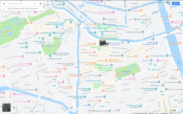
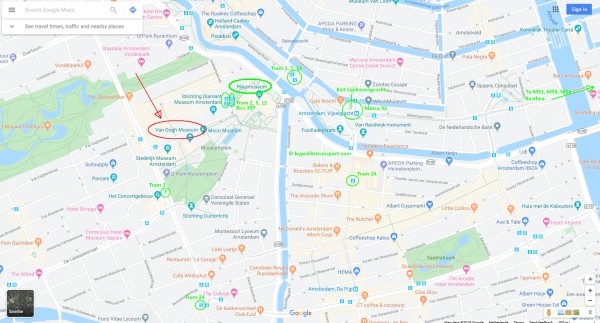
The map below shows the main tram and metro stops near the Van Gogh Museum.

(Click to open a large map in new tab)
how do i get to the van gogh museum amsterdam by public transport 600 x 323

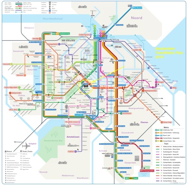
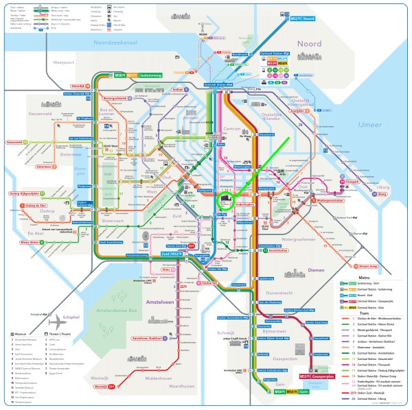
The metro/tram map below, might help you to find the best options for you.

(Click to open a large map in new tab)
amsterdam metro tram map plan van gogh museum 600 x 596

Best options
T = Tram, M = Metro, B = Bus, > = Transfer

From Number Stop Remarks
Amsterdam Centraal station T2 or T12 Rijksmuseum or Van Baerlestraat Stops next to Museumplein (Museum Square)
Amsterdam Amstel station T12 Rijksmuseum or Van Baerlestraat Stops next to Museumplein (Museum Square)
Amsterdam Sloterdijk station T19 Spiegelgracht + 5 minutes walk
Amsterdam Lelylaan station T1 Spiegelgracht + 5 minutes walk
Amsterdam Zuid station M52 Vijzelgracht + 8 minutes walk
Amsterdam RAI station M52 Vijzelgracht + 8 minutes walk
Duivendrecht station M50 > M52 Vijzelgracht Transfer at station Zuid
Amsterdam Bijlmer ArenA station M50 > M52 Vijzelgracht Transfer at station Zuid
Amsterdam Muiderpoort railway station T1 Spiegelgracht + 5 minutes walk
Amsterdam Noord M52 Vijzelgracht + 8 minutes walk
Amsterdam Airport Schiphol B397 Rijksmuseum Stops next to Museumplein (Museum Square)
Schiphol Airport railway station Train > M52 Vijzelgracht More information


Entrances
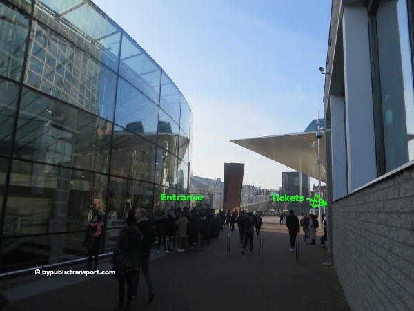
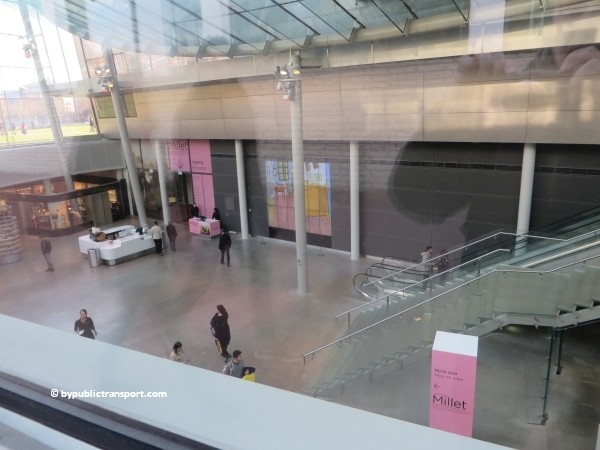
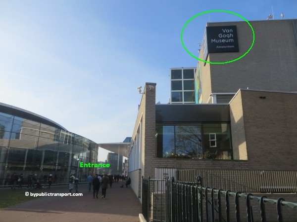
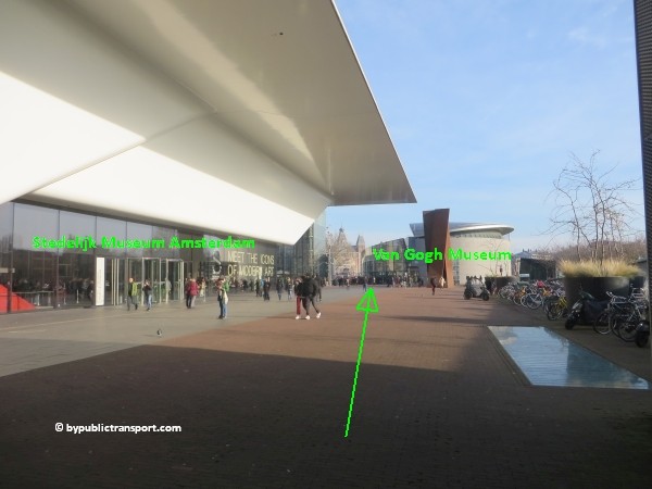
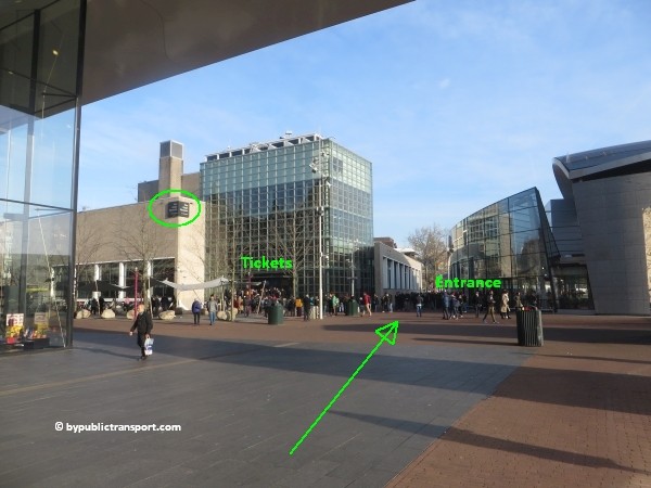
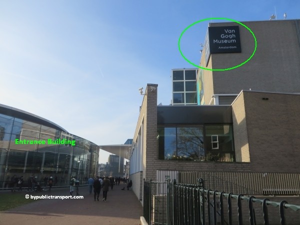
Since September 5, 2015 visitors enter the Van Gogh Museum through a spectacular new glass structure at the west side of Museumplein (Museum Square). You can purchase tickets opposite the entrance. To avoid the lines and save time, you can also buy your tickets online, prior to your visit. To save even more time and money, ticket companies offer tickets for the Van Gogh Museum in combination with other activities in Amsterdam click here for more information (Tours & Tickets).
how do i get to the van gogh museum amsterdam by public transport 02

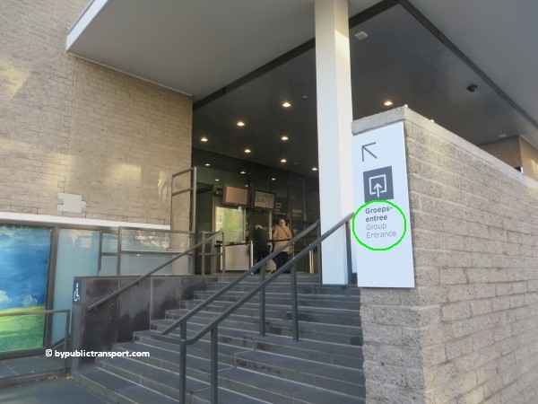
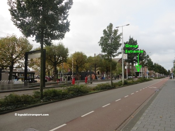
Group Entrance
Note that the entrance for large groups is still at the grey brick building at Paulus Potterstraat 7.
how do i get to the van gogh museum amsterdam by public transport 03

how do i get to the van gogh museum amsterdam by public transport 04


Metro 52
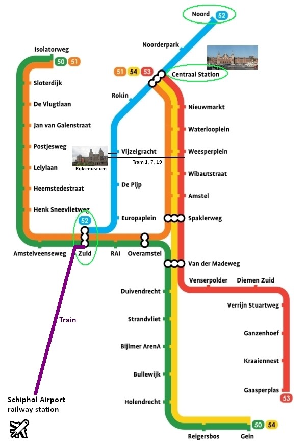
Since July 2018, metro 52 (North/Southline) runs between station Zuid and Centraal Station (and on to Amsterdam-Noord). The stop at Vijzelgracht, exit Vijzelgracht, is just an 8 minutes walk from the Van Gogh Museum. Make sure you travel in the right direction. Use the metro map below to determine whether you have to take metro 52 in the north or south direction.
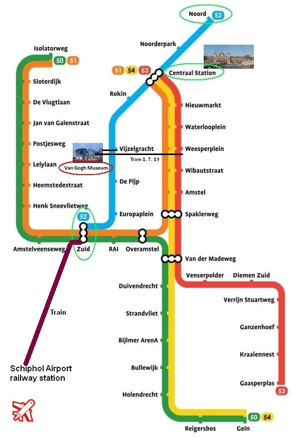
amsterdam metro map plan van gogh museum amsterdam

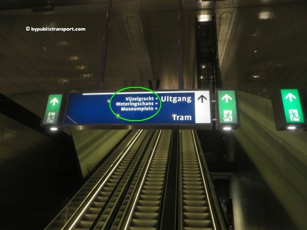
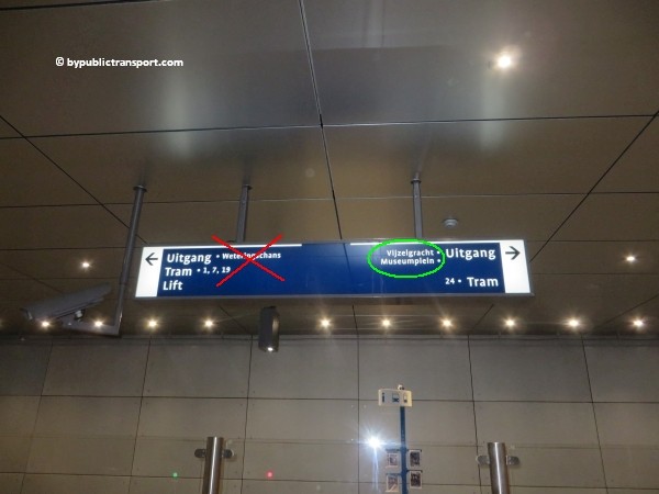
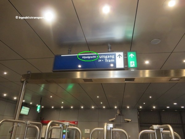
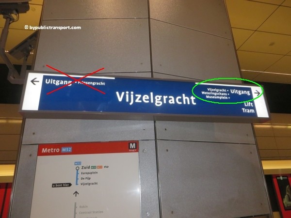
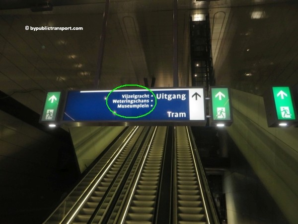
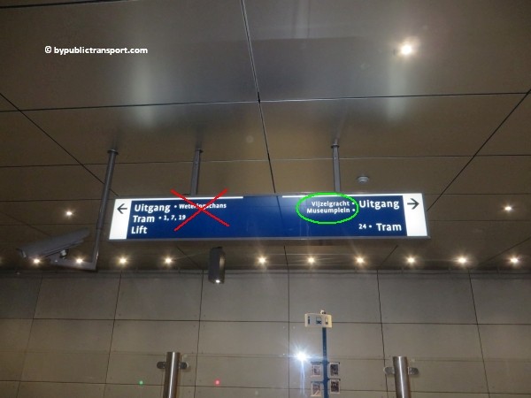
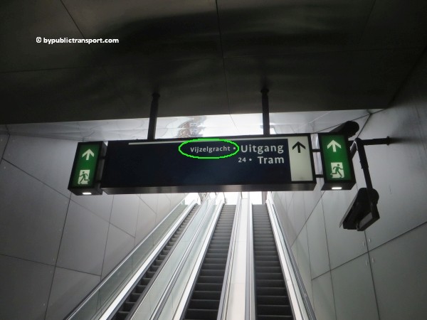
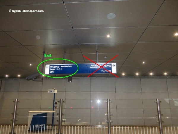
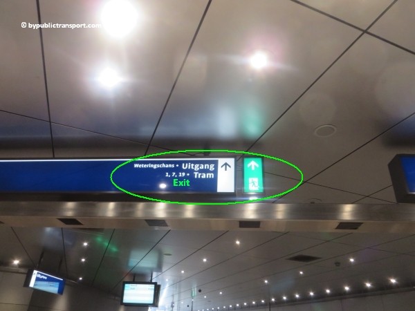
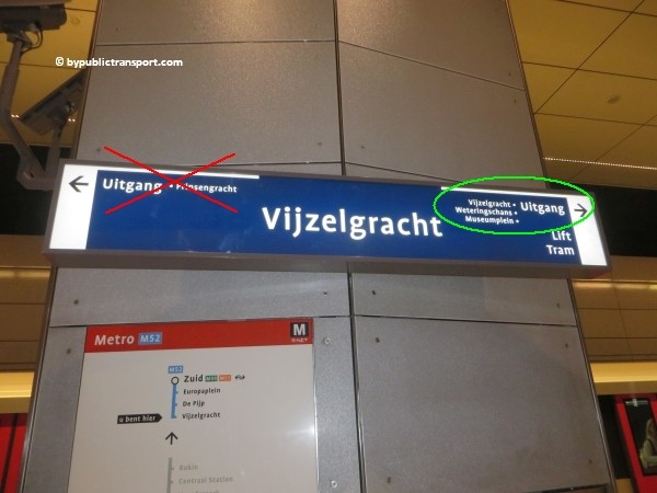
After exiting the metro train follow the signs Uitgang (exit) Vijzelgracht / Museumplein (Museum Square).
how do i get to the van gogh museum amsterdam by public transport 05

how do i get to the van gogh museum amsterdam by public transport 06

how do i get to the van gogh museum amsterdam by public transport 07

how do i get to the van gogh museum amsterdam by public transport 08

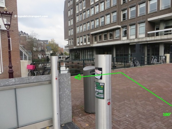
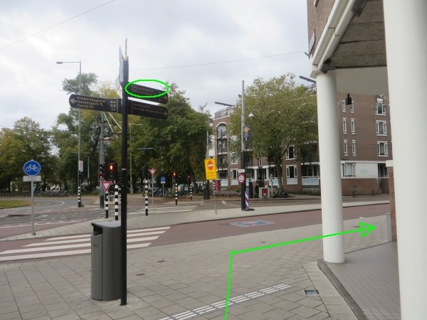
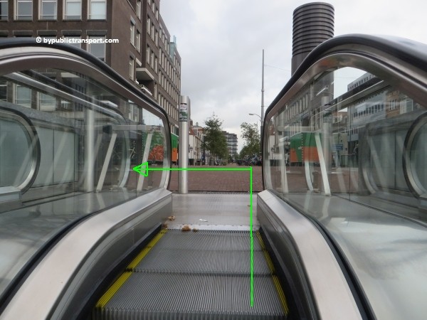
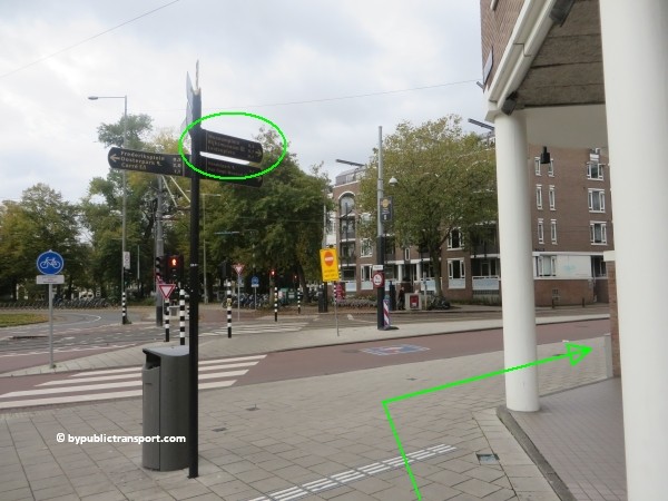
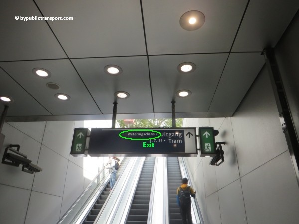
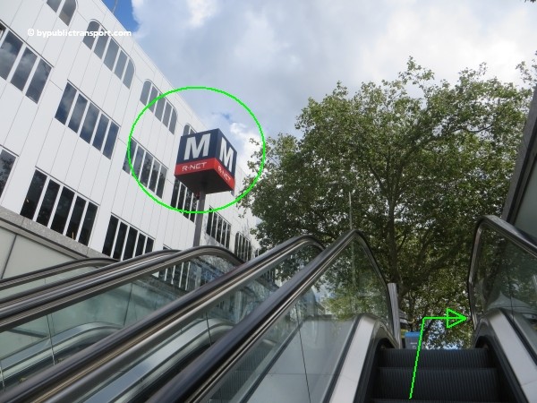
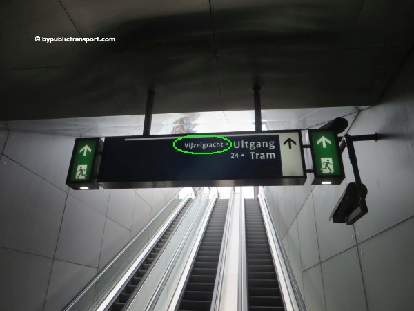
Use the 2 escalators to go upstairs and exit the station. As soon as you’ve left the last escalator, turn to the left and make a 180 degree turn. Walk to the corner at Weteringschans (only 30 meters). At the corner, turn to to the right. There’s a signpost pointing to the Museumplein (Museum Square) at the corner.
how do i get to the van gogh museum amsterdam by public transport 09

how do i get to the van gogh museum amsterdam by public transport 10

how do i get to the van gogh museum amsterdam by public transport 11

how do i get to the van gogh museum amsterdam by public transport 12

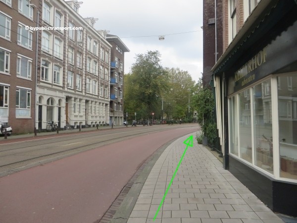
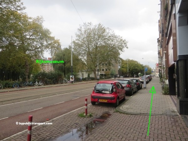
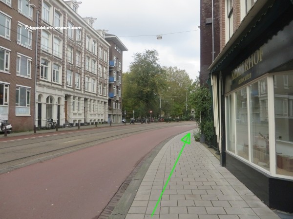
Now follow the Weteringschans to the tram stop Spiegelgracht. When you look to the left at Weteringschans, you might see the Rijksmuseum. Museumplein (Museum Square) and the Van Gogh Museum is just behind the Rijksmuseum. Use the pedestrian crossing at the end of the tram stop to cross Weteringschans. Take care, at busy moments cars, trams, taxis, and bicycles usually come from everywhere at this point. Cyclists in Amsterdam might ring their bicycle bells, but usually don’t stop and might kill you.
how do i get to the van gogh museum amsterdam by public transport 13

how do i get to the van gogh museum amsterdam by public transport 14

how do i get to the van gogh museum amsterdam by public transport 15

how do i get to the van gogh museum amsterdam by public transport 16

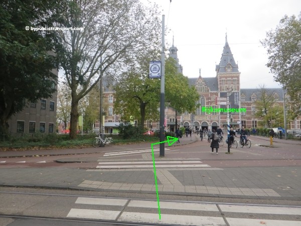
Now just follow the sidewalk to the Rijksmuseum. You’ll cross the bridge at Stadhouderskade. Use the pedestrian crossing to cross the street. Take your time and wait for the green pedestrian light, as this street is usually very busy.
how do i get to the van gogh museum amsterdam by public transport 17

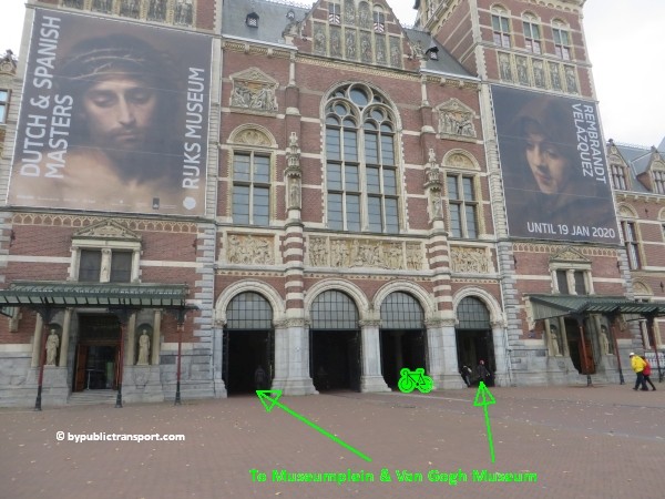
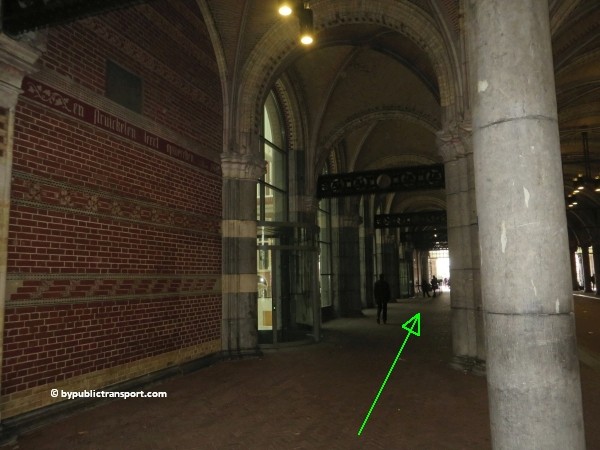
As soon as you’ve reached the other side, you walk trough the arcade of the Rijksmuseum to the Museumplein (Museum Square) at the south side of the museum.

how do i get to the van gogh museum amsterdam by public transport 18

how do i get to the van gogh museum amsterdam by public transport 19

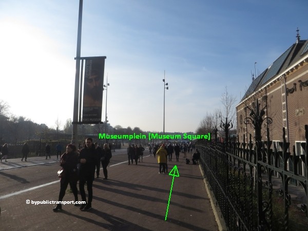
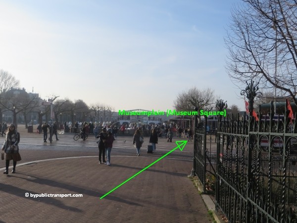
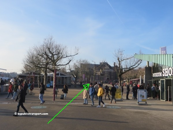
During the cold months of the year you might see an artificial skating rink in the middle of Museumplein (Museum Square). Keep walking straight ahead at the right side of the square.

how do i get to the van gogh museum amsterdam by public transport 20

how do i get to the van gogh museum amsterdam by public transport 21

how do i get to the van gogh museum amsterdam by public transport 22

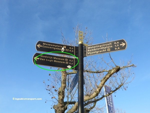
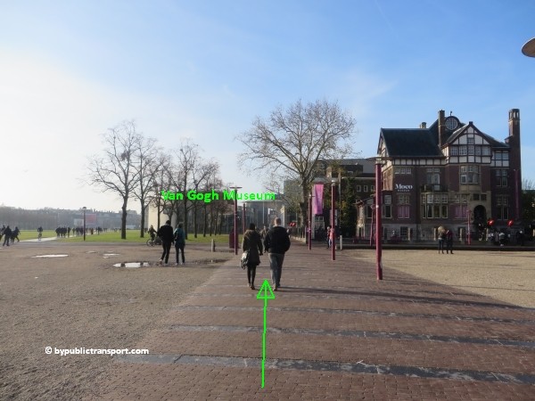
To make sure you walk in the right direction, take a look at the green signpost. Follow the walkway and keep walking straight ahead for 3 minutes. You’ll pass the independent Moco Museum at your right side. Soon you’ll see the glass entrance building of the Van Gogh Museum.
how do i get to the van gogh museum amsterdam by public transport 23

how do i get to the van gogh museum amsterdam by public transport 24

how do i get to the van gogh museum amsterdam by public transport 25

how do i get to the van gogh museum amsterdam by public transport 26

Metro (51), 53, 54
This is the old metro line (Eastline), starting at Centraal Station, and going to Amsterdam-Southeast (Bijlmer, Amsterdam Zuid-Oost). You can still take all 3 metros and transfer to tram 1, 7, 19 just outside metro stop Weesperplein. Get off at tram stop Spiegelgracht. From the tram stop it’s a 5 minutes walk to the Van Gogh Museum.

Tram 1, 7, 19
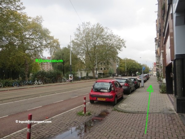
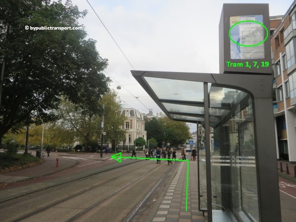
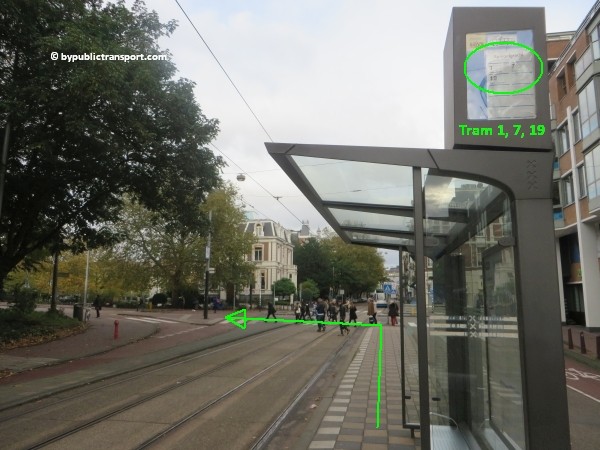
These trams pass the Rijksmuseum and the Museumplein (Museum Square) behind it at the city center (north) side. Get off at the tram and bus stop Spiegelgracht. From the tram stop it’s a 5 minutes walk to the museum. You can find the images of this route HERE.


Tram 2, 5, 12
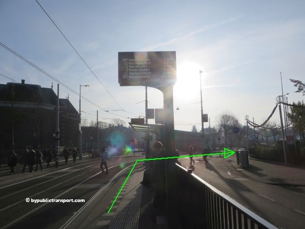
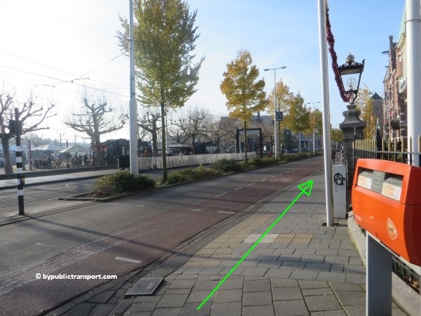
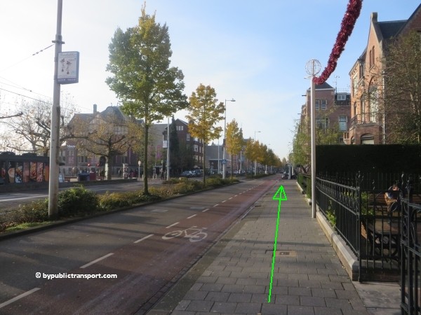
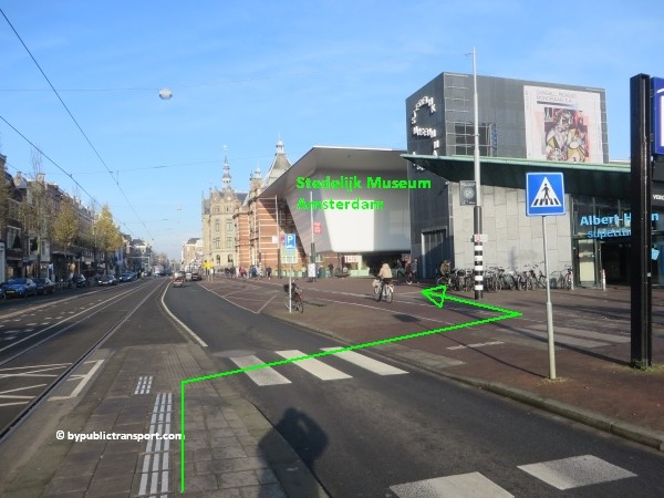
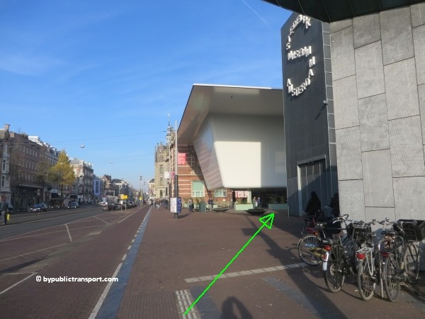
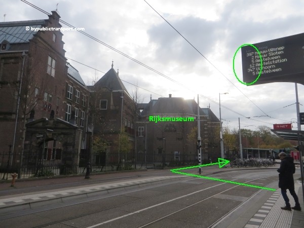
These trams stop next to the Museumplein (Museum Square) at tram stop Rijksmuseum and tram stop Van Baerlestraat. This is close to the Van Gogh Museum. Walking to the entrance takes a minute or 3. When exiting the tram, cross the street in opposite direction of the Rijksmuseum. Just follow the side walk, starting at the red Mailboxes as shown below.
how do i get to the van gogh museum amsterdam by public transport 27

how do i get to the van gogh museum amsterdam by public transport 28

how do i get to the van gogh museum amsterdam by public transport 29

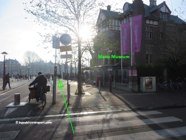
At Honthorststraat, cross the street using the pedestrian crossing in direction of the Moco Museum. Note the pink flags opposite the street.
how do i get to the van gogh museum amsterdam by public transport 30

how do i get to the van gogh museum amsterdam by public transport 31

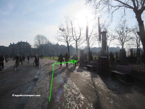
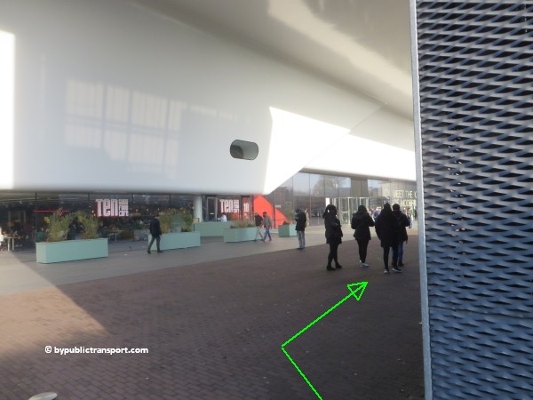
Walk to the corner at the Moco Museum and turn to the right. Soon you’ll see the glass entrance building of the Van Gogh Museum.
how do i get to the van gogh museum amsterdam by public transport 32

how do i get to the van gogh museum amsterdam by public transport 33

Tram 3
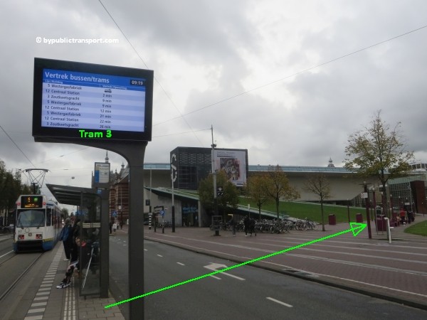
Tram 3 circles within the old part of Amsterdam, but outside the city center and canal area, passing the Museumplein (Museum Square) at the Concertgebouw (south) side of the Museumplein. This is the closest tram stop near the Van Gogh Museum. You can take this tram for example, if you’ve visited the neighborhood called De Pijp (The Pipe) with it’s lively Albert Cuyp Market, just south of the city center. Tram 3 also stops just in front of exit Ceintuurbaan of De Pijp metro station at metro line 52 (North/Southline).

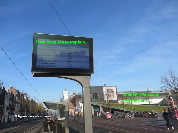
Get off at tram stop Museumplein. Cross the street to Museumplein (Museum Square) and simply walk to the Van Gogh Museum at the left/west side of the square. This might take 3 minutes. Tram 5 and 12 also stop at tram stop Museumplein.
how do i get to the van gogh museum amsterdam by public transport 34

how do i get to the van gogh museum amsterdam by public transport 35

how do i get to the van gogh museum amsterdam by public transport 36

how do i get to the van gogh museum amsterdam by public transport 37

how do i get to the van gogh museum amsterdam by public transport 38

how do i get to the van gogh museum amsterdam by public transport 39

how do i get to the van gogh museum amsterdam by public transport 40

Amsterdam Airport Schiphol
The Amsterdam Airport Express is a fast and easy way to travel by bus between Amsterdam Airport Schiphol and the center of Amsterdam. Every 7.5 minutes bus line 397 departs from bus stops B15-19 at Schiphol. The bus brings you directly to bus and tram stop Rijksmuseum, next to the Museumplein (Museum Square). Walking to the entrance takes only a minute or 3. You can find the images of this route here.

Schiphol Airport railway station
The railway station is beneath the airport. Every 6 minutes, you can take a train to Amsterdam Zuid station. 7 minutes later you’ll arrive. From station Zuid, you can take metro 52 (also every 6 minutes) and exit 5 minutes later at metro stop Vijzelgracht. From Vijzelgracht, it’s an 8 minutes walk to the Van Gogh Museum. So, it’s possible to travel from Schiphol Airport railway station to the Van Gogh Museum in about half an hour. For a description of the walking route to the museum, click here.

Enjoy your trip to the Van Gogh Museum!

Last update: December 8, 2019

How do I get to the Rijksmuseum Amsterdam by Public Transport?

Rijksmuseum
The Rijksmuseum is the main national museum in Amsterdam, dedicated to arts and history. The museum is located at the Museumplein (Museum Square) in the borough Amsterdam South, just south of the city center and is close to the Van Gogh Museum, the Stedelijk Museum Amsterdam, and the Concertgebouw. The Rijksmuseum is definitely one of Amsterdam’s must-see attractions.

The main building was designed by Pierre Cuypers, who also designed Amsterdam Centraal station (Central Station). The Rijksmuseum opened in 1885. On 13 April 2013, after a ten-year renovation which cost € 375 million, the main building was reopened by Queen Beatrix. In 2013 and 2014, it was the most visited museum in the Netherlands with record numbers of 2.2 million and 2.47 million visitors. It is also the largest art museum in the country.

The museum has on display 8,000 objects of art and history, from a total collection of 1 million objects. The most famous objects are masterpieces by Rembrandt van Rijn, Frans Hals, and Johannes Vermeer. The most famous painting in the Rijksmuseum is De Nachtwacht (The Night Watch), a 1642 painting by Rembrandt van Rijn. The museum also has a small Asian collection, which is on display in the Asian pavilion.

Address
Rijksmuseum
Museumstraat 1
1071 XX Amsterdam

Floor plan
Download a floor plan of the Rijksmuseum by clicking on the icon below (opens in new tab).

rijksmuseum amsterdam floorplan english pdf download

More information

Other sources
This article is meant for the vast majority of travelers and covers the most important options. If you are looking for detailed information, or if you are traveling to or from less visited locations, then consult other sources:

How do I get there?
The city center of Amsterdam is small. Since the Rijksmuseum is situated just a little south of the city center, many people visit the museum simply by foot or by rented bike. For example, a walk from Dam Square to the Rijksmuseum would take 20 minutes and you’ll pass the famous canals of Amsterdam along the way. It is possible to park your car near the Rijksmuseum. However, the number of parking places available is limited and parking in Amsterdam is very expensive. Under the Museumplein is a supervised underground parking garage. The entrance is at the side of the Concertgebouw, next to the Albert Heijn supermarket. Taxis in The Netherlands are expensive and the Rijksmuseum is in a busy area, so the best way to visit the Rijksmuseum is by foot, rented bike, or public transport.

Public transport options
The Rijksmuseum is located just south of the city center of Amsterdam, in a busy area. There are many public transport options, which can make it slightly confusing. The one which is the best for you, depends on your starting point (e.g. hotel or railway station). You can reach the Rijksmuseum from 9 railway stations in the Amsterdam area. Located at the Museumplein are three major museums. Museumplein (Museum Square) is a nice public square. So if you arrive anywhere near Museumplein (Museum Square) by public transport and don’t mind to walk a couple of minutes, you should be fine.

The map below shows the main tram and metro stops near the Rijksmuseum.

(Click to open a large map in new tab)
rijksmuseum amsterdam tram metro stops nearby 600 x 323

The metro/tram map below, might help you to find the best options for you.

(Click to open a large map in new tab)
amsterdam metro tram map plan rijksmuseum 600 x 596

Best options
T = Tram, M = Metro, B = Bus, > = Transfer

From Number Stop Remarks
Amsterdam Centraal station T2 or T12 Rijksmuseum Stops next to the museum
Amsterdam Amstel station T12 Rijksmuseum Stops next to the museum
Amsterdam Sloterdijk station T19 Spiegelgracht + 3 minutes walk
Amsterdam Lelylaan station T1 Spiegelgracht + 3 minutes walk
Amsterdam Zuid station M52 Vijzelgracht + 6 minutes walk
Amsterdam RAI station M52 Vijzelgracht + 6 minutes walk
Duivendrecht station M50 > M52 Vijzelgracht Transfer at station Zuid
Amsterdam Bijlmer ArenA station M50 > M52 Vijzelgracht Transfer at station Zuid
Amsterdam Muiderpoort railway station T1 Spiegelgracht + 3 minutes walk
Amsterdam Noord M52 Vijzelgracht + 6 minutes walk
Amsterdam Airport Schiphol B397 Rijksmuseum Stops next to the museum
Schiphol Airport railway station Train > M52 Vijzelgracht More information


Entrances
There are 4 entrances to the Rijksmuseum from the Passage. The Passage is a public thoroughfare for cyclists and pedestrians, under the building, running from the north to the south side of the museum. There are no signs to the entrances, but you’ll see the revolving door, and probably museum employees and visitors in lines.


Metro 52
Since July 2018, metro 52 (North/Southline) runs between station Zuid and Centraal Station (and on to Amsterdam-Noord). The stop at Vijzelgracht, exit Vijzelgracht, is just a 6 minutes walk from the Rijksmuseum. Make sure you travel in the right direction. Use the metro map below to determine whether you have to take metro 52 in the north or south direction.
amsterdam metro map plan rijksmuseum amsterdam

After exiting the metro train follow the signs Uitgang (exit) Vijzelgracht / Museumplein.
how do i get to the rijksmuseum amsterdam by public transport 01

how do i get to the rijksmuseum amsterdam by public transport 02

how do i get to the rijksmuseum amsterdam by public transport 03

how do i get to the rijksmuseum amsterdam by public transport 04

how do i get to the rijksmuseum amsterdam by public transport 05

Use the 2 escalators to go upstairs and exit the station. As soon as you’ve left the last escalator, turn to the left and make a 180 degree turn. Walk to the corner at Weteringschans (only 30 meters). At the corner, turn to to the right. There’s a signpost pointing to the Rijksmuseum at the corner.
how do i get to the rijksmuseum amsterdam by public transport 06

how do i get to the rijksmuseum amsterdam by public transport 07

how do i get to the rijksmuseum amsterdam by public transport 08

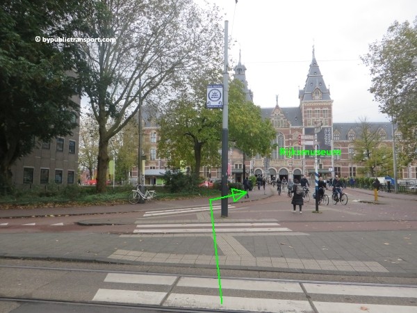
Now follow the Weteringschans to the tram stop Spiegelgracht. When you look to the left at Weteringschans, you might already see the Rijksmuseum. Use the pedestrian crossing at the end of the tram stop to cross Weteringschans. Take care, at busy moments cars, trams, taxis, and bicycles usually come from everywhere at this point. Cyclists in Amsterdam might ring their bicycle bells, but usually don’t stop and might kill you.
how do i get to the rijksmuseum amsterdam by public transport 09

how do i get to the rijksmuseum amsterdam by public transport 10

how do i get to the rijksmuseum amsterdam by public transport 11

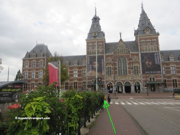
Now just follow the sidewalk to the museum. You’ll cross the bridge at Stadhouderskade. Use the pedestrian crossing to cross the street. Take your time and wait for the green pedestrian light, as this street is usually very busy.
how do i get to the rijksmuseum amsterdam by public transport 12

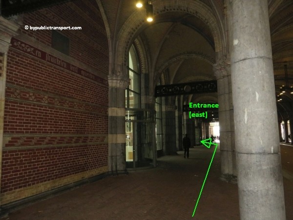
As soon as you’ve reached the other side, you walk to one of the entrances at the left or right side in the arcade. To avoid long lines at the ticket desk, purchase E-Tickets for the Rijksmuseum online.

how do i get to the rijksmuseum amsterdam by public transport 13

how do i get to the rijksmuseum amsterdam by public transport 14

how do i get to the rijksmuseum amsterdam by public transport 15

Metro (51), 53, 54
This is the old metro line (Eastline), starting at Centraal Station, and going to Amsterdam-Southeast (Bijlmer, Amsterdam Zuid-Oost). You can still take all 3 metros and transfer to tram 1, 7, 19 just outside metro stop Weesperplein. Get off at tram stop Spiegelgracht. From the tram stop it’s a 3 minutes walk to the museum.

Tram 1, 7, 19
These trams pass the Rijksmuseum at the city center (north) side. Get off at the tram and bus stop Spiegelgracht. From the tram stop it’s a 3 minutes walk to the museum.
how do i get to the rijksmuseum amsterdam by public transport 16

Tram 2, 5, 12
These trams stop next to the Rijksmuseum at tram stop Rijksmuseum. This is the closest tram stop near the museum. Walking to the entrance takes a minute or 3. Just follow the small side walk as shown below.
how do i get to the rijksmuseum amsterdam by public transport 17

Tram 3
Tram 3 circles within the old part of Amsterdam, but outside the city center and canal area, passing the Rijksmuseum at the Concertgebouw (south) side of the Museumplein. Get off at tram stop Museumplein. from here, it’s just a matter of crossing Museumplein (Museum Square) to the Rijksmuseum at the other side of the square. This might take 4 minutes.
how do i get to the rijksmuseum amsterdam by public transport 18

Amsterdam Airport Schiphol
The Amsterdam Airport Express is a fast and easy way to travel by bus between Amsterdam Airport Schiphol and the center of Amsterdam. Every 7.5 minutes bus line 397 departs from bus stops B15-19 at Schiphol. The bus brings you directly to bus and tram stop Rijksmuseum, next to the museum. Walking to the entrance takes only a minute or 3. Just follow the small side walk as shown below.
how do i get to the rijksmuseum amsterdam by public transport 17


Schiphol Airport railway station
The railway station is beneath the airport. Every 6 minutes, you can take a train to Amsterdam Zuid station. 7 minutes later you’ll arrive. From station Zuid, you can take metro 52 (also every 6 minutes) and exit 5 minutes later at metro stop Vijzelgracht. From Vijzelgracht, it’s a 6 minutes walk to the Rijksmuseum. So, it’s possible to travel from Schiphol Airport railway station to the Rijksmuseum within half an hour. For a description of the walking route to the museum, click here.

Enjoy your trip to the Rijksmuseum!

Last update: October 30, 2019
How do I get to the Heineken Experience Amsterdam by Public Transport?

Heineken Experience
The Heineken Experience is an attraction located at Heineken’s first built brewery near Amsterdam’s city center. In 1988, the brewery was closed due to the inability to meet the high demand. Nowadays, you can learn about Heineken’s heritage, brewing process, innovations, sponsorships and what it takes to serve a star in a 1.5 hour self-guided tour. At the end of the tour you can enjoy two Heinekens. Heineken is well known for its signature green bottle and red star.

The attraction grew to become one of Amsterdam’s most popular tourist attractions and by 2001 the visitor center changed its name to Heineken Experience. After a year of extensive remodeling and expansion, the Heineken Experience reopened to visitors on November 3, 2008. The latest transformation of the visitor experience comprises four levels of historical artifacts, product exploration and sampling, and interactive exhibits which employ the latest high-tech multi-media technologies.

Address
Heineken Experience
Stadhouderskade 78
1072 AE Amsterdam

More information

Other sources
This article is meant for the vast majority of travelers and covers the most important options. If you are looking for detailed information, or if you are traveling to or from less visited locations, then consult other sources:

How do I get there?
The Heineken Experience is situated in the famous neighborhood called De Pijp (The Pipe), just south of the city center. You can get there by foot. From Dam Square or Leidseplein, walking to the Heineken Experience will take about 20 minutes. However there are several tram and metro stops nearby, so you can also reach Heineken’s former brewery by public transport easily. It is possible to park your car near the Heineken Experience. However, the number of parking places available on the street is limited and parking your car in Amsterdam is very expensive. There are some supervised parking garages in the area. Taxis in The Netherlands are also very expensive and De Pijp is a busy neighborhood, so the best way to visit the Heineken Experience is by foot, rented bike, or public transport.

Public transport options
There are many public transport options, which can make it slightly confusing. The one which is the best for you, depends on your starting point (e.g. hotel or railway station). You can reach the Heineken Experience directly or with just 1 transfer from 9 railway stations in the Amsterdam area and also from Amsterdam Airport Schiphol. The map below shows the main tram and metro stops near the Heineken Experience.

(Click to open a large map in a new tab)
how do i get to the heineken experience amsterdam by public transport map 600x375

The metro/tram map below, might help you to find the best options for you.

(Click to open a large map in a new tab)
amsterdam metro tram map plan heineken experience 600 x 598

Best Options
T = Tram, M = Metro, B = Bus, > = Transfer

From Number Stop Remarks
Amsterdam Centraal station M52 Vijzelgracht + 3 minutes walk
Amsterdam Zuid station M52 Vijzelgracht + 3 minutes walk
Amsterdam RAI station 5 minutes walk to metro station Europaplein > M52 Vijzelgracht + 3 minutes walk
Amsterdam RAI station T4 Stadhouderskade + 7 minuten walk
Amsterdam Amstel station M51 > M52 Vijzelgracht Transfer at station Zuid
Amsterdam Amstel station T12 De Pijp + 9 minutes walk
Amsterdam Muiderpoort railway station T1 Vijzelgracht + 3 minutes walk
Amsterdam Lelylaan station T1 Vijzelgracht + 3 minutes walk
Amsterdam Sloterdijk station T19 Vijzelgracht + 3 minutes walk
Amsterdam Sloterdijk station Train Amsterdam CS > M52 Vijzelgracht Transfer at Centraal Station
Duivendrecht station M50 > M52 Vijzelgracht Transfer at station Zuid
Amsterdam Bijlmer ArenA station M50 > M52 Vijzelgracht Transfer at station Zuid
Amsterdam Noord M52 Vijzelgracht + 3 minutes walk
Schiphol Airport railway station Train > M52 Vijzelgracht Transfer at station Zuid
Meer informatie


Metro 52 (Noord/Zuidlijn)
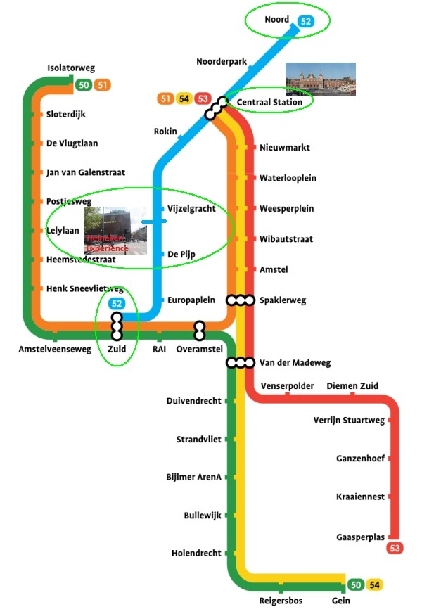
The easiest and fastest way to travel to the Heineken Experience is by metro 52 (Noord/Zuidlijn). This is Amsterdam’s latest metro line running from the northern part of Amsterdam under the IJ River, passing Centraal station, the city center, and down to station Zuid. The 9.2km-long line officially opened on July 22, 2018. In just 15 minutes, passengers can travel the 10km journey, with stops at Noorderpark Station on the north of the IJ River, Centraal Station, Rokin, Vijzelgracht, De Pijp and Europaplein. The efficient service runs every six minutes during the day and every seven to eight minutes in the evening.

Make sure you travel in the right direction. Use the metro map below to determine whether you have to take metro 52 in the north or south direction.
amsterdam metro map plan heineken experience

Walking route from Vijzelgracht metro station (M52).
The nearest metro station near The Heineken Experience is Vijzelgracht metro station. From the exit at Weteringschans it’s only a 3 minutes walk to the entrance of the Heineken Experience. Basically after exiting the station, it’s just a mater of crossing the roundabout and bridge at Stadhouderskade in front of the brewery.

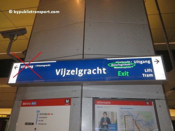
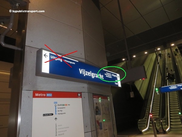
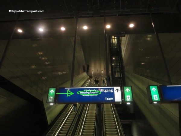
After exiting the metro train follow the signs Uitgang (exit) Weteringschans.
how do i get to the heineken experience amsterdam by public transport 02

how do i get to the heineken experience amsterdam by public transport 03

how do i get to the heineken experience amsterdam by public transport 04

how do i get to the heineken experience amsterdam by public transport 05

how do i get to the heineken experience amsterdam by public transport 06

how do i get to the heineken experience amsterdam by public transport 07

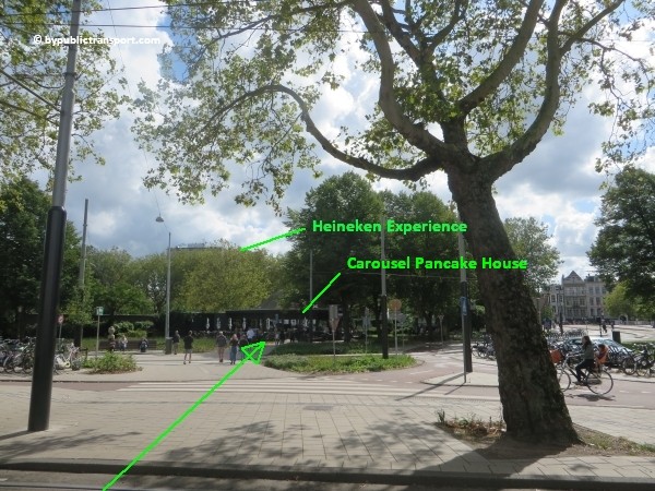
Use the 2 escalators to go upstairs and exit the station. As soon as you’ve left the last escalator, turn to the right. Now, when you look straight ahead, you’ll see the wooden Carousel Pancake House. Depending on the season you might already see the Heineken Brewery or it’s flat roof behind the Pancake Restaurant. Walk in the direction of the wooden pancake restaurant crossing the small streets and bicycle lanes by using the pedestrian crossings. Be careful, bicycles in Amsterdam usually come from all directions. They might ring their bicycle bells, but usually don’t stop and might kill you.

how do i get to the heineken experience amsterdam by public transport 08

how do i get to the heineken experience amsterdam by public transport 09

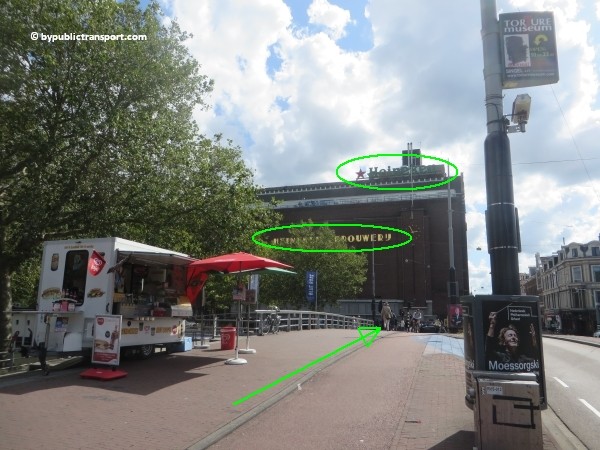
Now it’s just a matter of following the sidewalk to the Brewery. Just before the bridge in front of the brewery, there’s often a hot dog cart.
how do i get to the heineken experience amsterdam by public transport 10

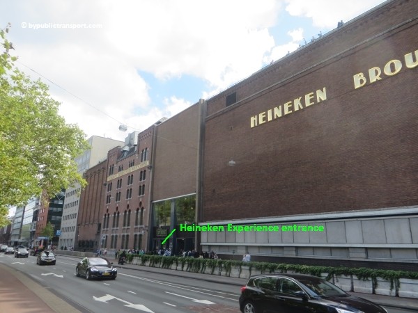
Use the pedestrian crossing to cross the Stadhouderskade. Take your time and wait for the green pedestrian light, as this street is usually very busy. As soon as you’ve reached the other side, you follow the brownish brick façade of the former Heineken brewery to the left and walk to the entrance of The Heineken Experience. You’ll probably see the lines near the entrance. To avoid long lines and save € 3,– per ticket, book your tickets online and in advance.

how do i get to the heineken experience amsterdam by public transport 11

how do i get to the heineken experience amsterdam by public transport 12

how do i get to the heineken experience amsterdam by public transport 13

Walking route from De Pijp metro station (M52).
Some people prefer to leave metro 52 at De Pijp metro station, as the nearest exit near The Heineken Experience is on the famous Albert Cuyp Market in the popular neighborhood De Oude Pijp (The Old Pipe). From the metro exit at Albert Cuyp Market, it’s an 8 minutes walk.

When leaving the metro train, follow the signs pointing to Uitgang (Exit) Albert Cuypstraat. Use the 2 escalators to go up and leave the station. As soon as you’ve left the metro station, you turn to the left in direction of Ferdinand Bolstraat (this is just 30 meters from the exit). At Ferdinand Bolstraat, you turn to the right and follow the small sidewalk in northern direction. You might see The McDonalds Restaurant on the little square opposite the street and Tram 24, going north to Amsterdam Centraal station, or south. The Heineken brewery is at the corner of Ferdinand Bolstraat and Stadhouderskade and is recognizable by it’s brownish bricks. The entrance of The Heineken Experience is around the corner at Stadhouderskade.

Trams
Metro 52 runs between the north part of Amsterdam and station Zuid (South). If you’re hotel or starting point is in the west or eastern parts of Amsterdam, traveling to the The Heineken Experience by tram might be a good option. There are several tram stops nearby.

Tram 1, 7, and 19
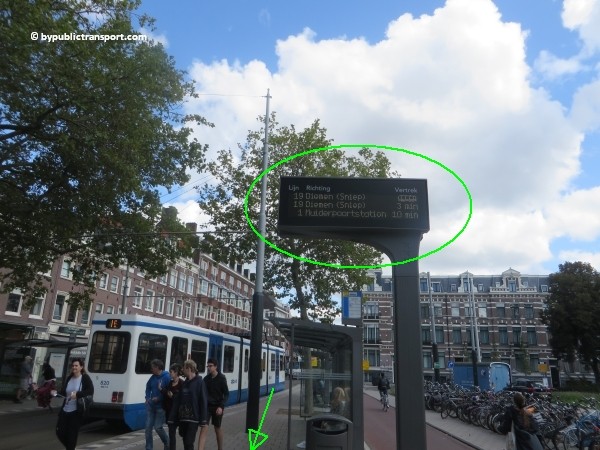
These trams stop just in front of Vijzelgracht metro station (M52) at exit Weteringschans. Leave the tram at tram stop Amsterdam, Vijzelgracht. It’s a 3 minutes walk to the entrance of the Heineken Experience. Follow the directions as described here.

how do i get to the heineken experience amsterdam by public transport 14

how do i get to the heineken experience amsterdam by public transport 15

Tram 3 and 12
Tram 3 and 12 both stop just in front of De Pijp metro station (M52) at exit Ceintuurbaan. When leaving the tram use the pedestrian crossing to cross Ceintuurbaan in direction of the metro station (M52). At Ferdinand Bolstraat, you follow the small side walk in norther direction. You pass The McDonalds Restaurant on the little square and you might see Tram 24, going north to Amsterdam Centraal station, or south. It’s a 9 minutes walk to entrance of the Heineken Experience. The Heineken brewery is at the corner of Ferdinand Bolstraat and Stadhouderskade and is recognizable by it’s brownish bricks. The entrance of The Heineken Experience is around the corner at Stadhouderskade.

Tram 24
Alternatively, you can take tram 24 at the same tram stop at Ceintuurbaan and leave the tram at the very next stop at tram stop Marie Heinekenplein, which is just around the corner of the entrance of The Heineken Experience at Stadhouderskade.


Schiphol Airport railway station
The railway station is beneath the airport. Every 6 minutes, you can take a train to Amsterdam Zuid station. 7 minutes later you’ll arrive. From station Zuid, you can take metro 52 (also every 6 minutes) and exit 6 minutes later at Vijzelgracht metro station , exit Weteringschans. From the exit of the metro station, it’s an 3 minutes walk to the Heineken Experience. So, it’s possible to travel from Schiphol Airport railway station to the Heineken Experience in less than half an hour. Click here for further information on this route.

Last update: November 18, 2021

Hoe kom ik bij de Johan Cruijff ArenA met het Openbaar Vervoer?

Johan Cruijff ArenA
De Johan Cruijff ArenA, tot 2018 Amsterdam ArenA, is een multifunctioneel stadion in Amsterdam bij de Johan Cruijff Boulevard. Het stadion ligt op nog geen 200 meter van station Amsterdam Bijlmer ArenA en is goed bereikbaar per trein, metro en bus. Het stadion werd op 14 augustus 1996 door koningin Beatrix geopend. Het is met 54.990 plaatsen het grootste stadion van Nederland. De Johan Cruijff ArenA is de thuisbasis van voetbalclub AFC Ajax. Sinds de start van het voetbalseizoen 2018-2019 draagt het stadion de naam Johan Cruijff ArenA. In 2020 is de ArenA een van de speelstadions voor het EK.
Naast de wedstrijden van Ajax wordt de Johan Cruijff ArenA gebruikt voor interlands van het Nederlands elftal, de wedstrijd om de Johan Cruijff Schaal en andere belangrijke voetbalwedstrijden. Daarnaast wordt het stadion gebruikt voor popconcerten en andere grote manifestaties. Hoewel het stadion geschikt zou zijn voor concerten, wordt de geluidskwaliteit vaak bedroevend genoemd.

Nadere informatie over de Johan Cruijff ArenA

Andere bronnen
Dit artikel is bedoeld voor de meerderheid van reizigers en behandelt alleen de belangrijkste opties. Als je op zoek bent naar gedetailleerde informatie, of je reist vanaf minder bekende locaties raadpleeg dan andere bronnen:

Trein

Station Amsterdam Bijlmer ArenA
De Johan Cruijff ArenA ligt op 5 minuten lopen van station Amsterdam Bijlmer ArenA. Dit is een treinstation, maar metro 50 en 54 en verschillende (streek)buslijnen stoppen hier ook. Dit station moet overigens niet verward worden met Halte Amsterdam ArenA. Dit laatste is een spoorweghalte bij de Johan Cruijff ArenA, speciaal voor supporterstreinen bij risicowedstrijden.

Treinen
Treinen die station Amsterdam Bijlmer ArenA aandoen rijden vaak via:

  • Utrecht Centraal
  • Amsterdam Centraal
  • Amsterdam Airport Schiphol

Mocht er geen rechtstreekse trein zijn uit jouw regio, dan kunt je vaak overstappen op een van deze stations. Station Amsterdam Bijlmer ArenA is per trein rechtstreeks onder andere bereikbaar vanuit:

  • Utrecht, Amsterdam Centraal, Amsterdam Airport Schiphol, Den Haag, Leiden en Rotterdam
  • Ede-Wageningen, Arnhem Centraal, Nijmegen
  • ‘s-Hertogenbosch, Eindhoven, Helmond, Venlo
  • Uitgeest, Zaandam, Breukelen, Woerden, Gouda, Driebergen-Zeist, Rhenen

Metro

De Johan Cruijff ArenA is ook prima bereikbaar met de metro vanuit de meeste treinstations in Amsterdam.

Station Metro Richting
Station Amsterdam Centraal M54 Gein
Station Amsterdam Amstel M54 Gein
Station Amsterdam Sloterdijk M50 Gein
Station Amsterdam Lelylaan M50 Gein
Station Amsterdam Zuid M50 Gein
Station Amsterdam RAI M50 Gein
Station Duivendrecht M50 + M54 Gein


Metrolijn 52 (Noord/Zuidlijn)
Wil je met de Noord/Zuidlijn naar de Johan Cruijff ArenA? Dat kan, maar je moet wel overstappen.

Richting Zuid
Omdat het stadion ten zuiden van Amsterdam is gelegen, zal het vaak het snelste zijn om metro 52 richting station Zuid te nemen. Het eindpunt van deze metro is station Zuid. Op station Zuid ga je met de trap naar beneden. Je hoeft niet door de GVB-poortjes en checkt niet uit. Beneden de trap ga je naar links en met de trap of roltrap weer omhoog naar het perron van metro 50 richting Gein. Metro 50 brengt je vervolgens naar het stadion.

Richting Noord
Wilt je liever met de Noord/Zuidlijn (52) via Centraal Station reizen, of bent je per ongeluk in metro 52 richting Noord gestapt? Stap dan op Centraal Station over op metro 54 richting Gein. Metro 54 brengt je vervolgens naar het stadion.

Welke halte moet ik uitstappen?
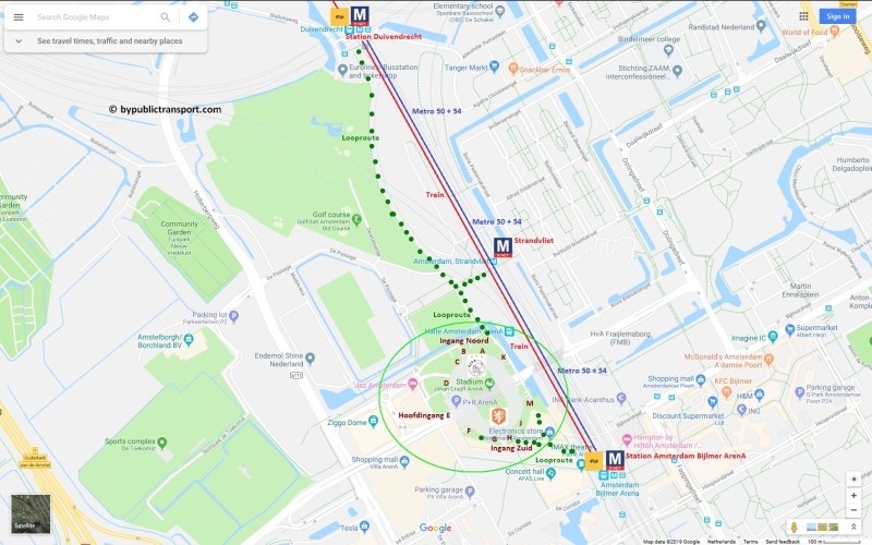
Veel bezoekers van de Johan Cruijff ArenA zijn vanwege de naam van het station geneigd uit te stappen op trein- en metrostation Amsterdam Bijlmer ArenA. Het stadion is echter heel groot en ligt tussen 2 metrostations in. Er zijn 2 haltes waar je uit kunt stappen: metrostation Strandvliet en station Bijlmer ArenA. Welk station het handigste is hangt af van het vak waar je kaartjes voor hebt. Besef hierbij ook dat de looproute vanaf metrostation Strandvliet veel rustiger is en je niet via de drukke Johan Cruijff Boulevard hoeft te lopen. Aan de zijde van metrostation Strandvliet zijn er tijdens grote evenementen ook kramen met eten, drinken en fan-merchandise.

Metrostation Strandvliet
Stap hier uit voor de vakken: A, B, C, D, en K. Eventueel kun je hier ook uitstappen voor de hoofdingang (E).

Metro- en treinstation Amsterdam Bijlmer ArenA
Stap hier uit voor de vakken: E (hoofdingang), F, G, H, J en M.

(Click voor een grote kaart in een nieuw venster)amsterdam johan cruijff arena met openbaar vervoer by public transport detailed area map

Looproutes

Looproute vanuit trein- en metrostation Amsterdam Bijlmer ArenA
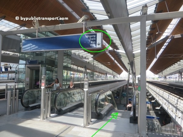
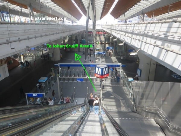
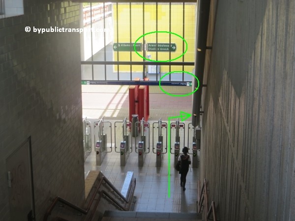
Verlaat de metro- of trein en loop richting de roltrap- of lift. Voor de metro loop je tegengesteld aan de rijrichting; richting de achterzijde van de metro dus. Ga met de roltrap of lift naar beneden en check uit bij de juiste vervoerder. Voor de trein check je uit bij een poortje van de NS. Als je met de metro bent gekomen, check je uit bij het GVB.

amsterdam johan cruijff arena met openbaar vervoer by public transport 01

amsterdam johan cruijff arena met openbaar vervoer by public transport 02

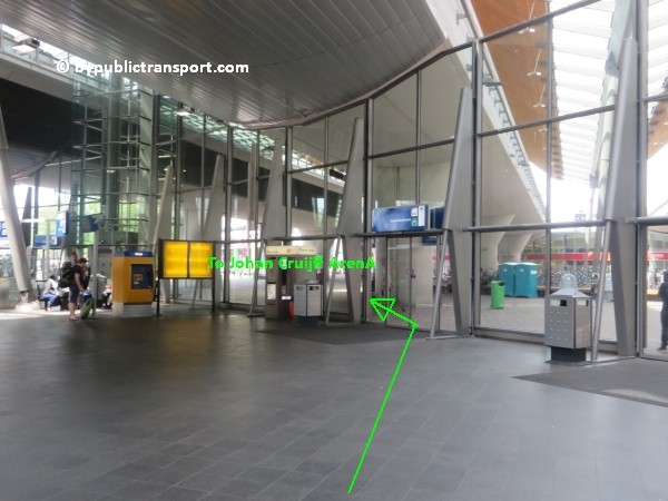
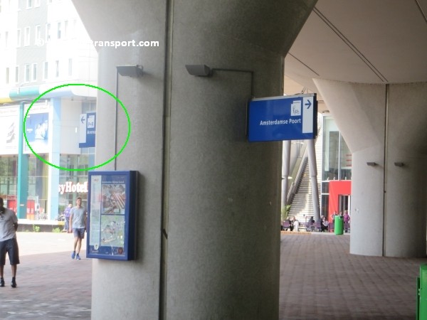
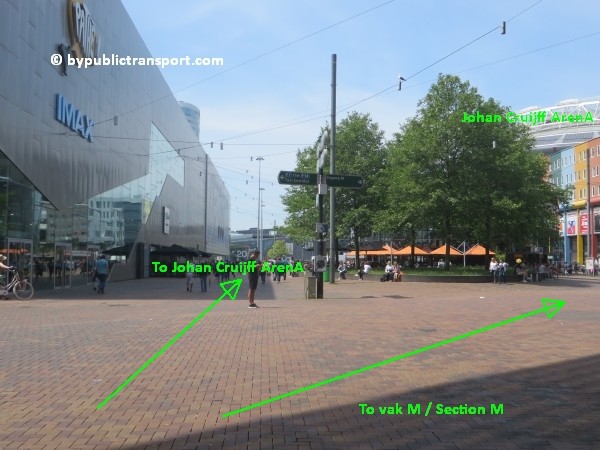
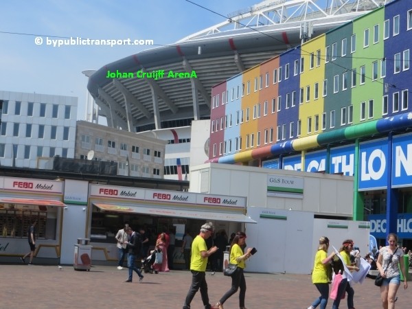
Na het uitchecken loop je naar links en verlaat je het station via een van de glazen schuifdeuren. Via de Johan Cruijff Boulevard loop je in een paar minuten naar de Johan Cruijff ArenA. De Johan Cruijff Boulevard is onder andere herkenbaar aan de grote Pathé Arena IMAX bioscoop en grote MediaMarkt, Prénatal en Decathlon winkels.

amsterdam johan cruijff arena met openbaar vervoer by public transport 03

amsterdam johan cruijff arena met openbaar vervoer by public transport 04

amsterdam johan cruijff arena met openbaar vervoer by public transport 05

Vak M
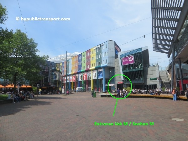
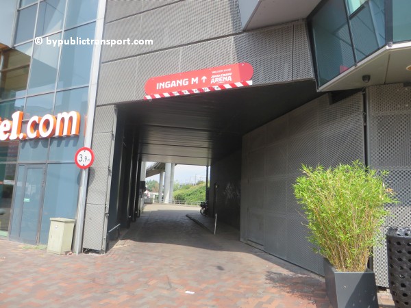
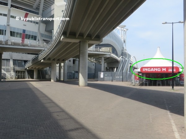
Dit vak is het makkelijkst en snelst bereikbaar via een doorsteekje naast het easyHotel Amsterdam Johan Cruijff Boulevard.

amsterdam johan cruijff arena met openbaar vervoer by public transport 06

amsterdam johan cruijff arena met openbaar vervoer by public transport 07

amsterdam johan cruijff arena met openbaar vervoer by public transport 08

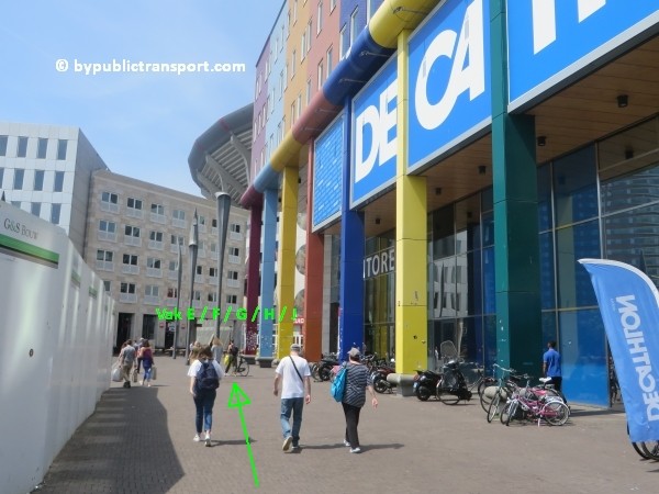
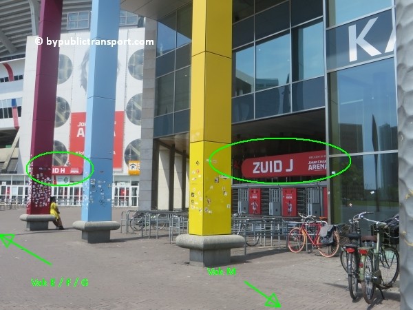
Voor de overige vakken loop je voorbij de MediaMarkt en Decathlon winkels. De ingangen voor de vakken J / H zijn net voorbij Decathlon.

amsterdam johan cruijff arena met openbaar vervoer by public transport 09

amsterdam johan cruijff arena met openbaar vervoer by public transport 10

amsterdam johan cruijff arena met openbaar vervoer by public transport 11

Looproute vanuit metrostation Strandvliet
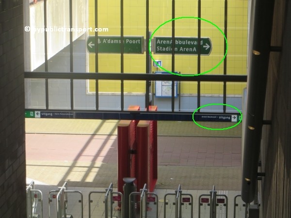
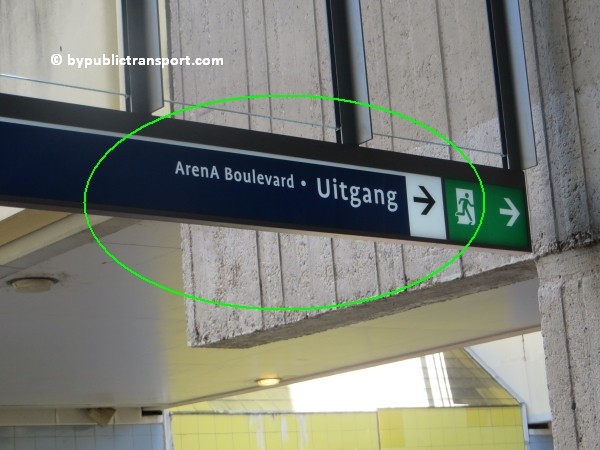
Het station heeft een eilandperron met aan beide uiteinden een uitgang. De zuidelijke uitgang vervult een rol in het stadionvervoer ten behoeve van de ArenA. Loop in de richting van de voorzijde van de metrotrein en loop via de trap naar beneden. De ArenA is aangegeven op een blauw bord onder aan de trap. Check uit bij de GVB-poortjes en verlaat het station naar rechts.

amsterdam johan cruijff arena met openbaar vervoer by public transport 12

amsterdam johan cruijff arena met openbaar vervoer by public transport 13

amsterdam johan cruijff arena met openbaar vervoer by public transport 14

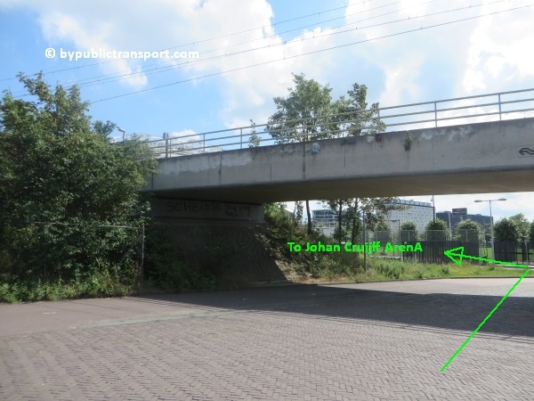
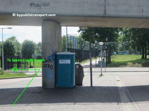
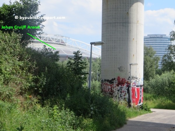
Ga onder de smalle viaduct door en sla af naar links, langs het trainingsveld. De Johan Cruijff ArenA wordt meteen zichtbaar en is 3 minuten lopen.

amsterdam johan cruijff arena met openbaar vervoer by public transport 15

amsterdam johan cruijff arena met openbaar vervoer by public transport 16

Route vanuit station Duivendrecht
Als je per trein bent aangekomen op station Duivendrecht kun je overstappen op de metro 50 en 54 richting Gein naar metrostation Strandvliet (1 halte) en metro- en treinstation Amsterdam Bijlmer ArenA (2 haltes). Er is echter ook een goede, makkelijke wandelroute naar de Johan Cruijff ArenA. De wandeling duurt ongeveer 10 minuten.

Wandelroute
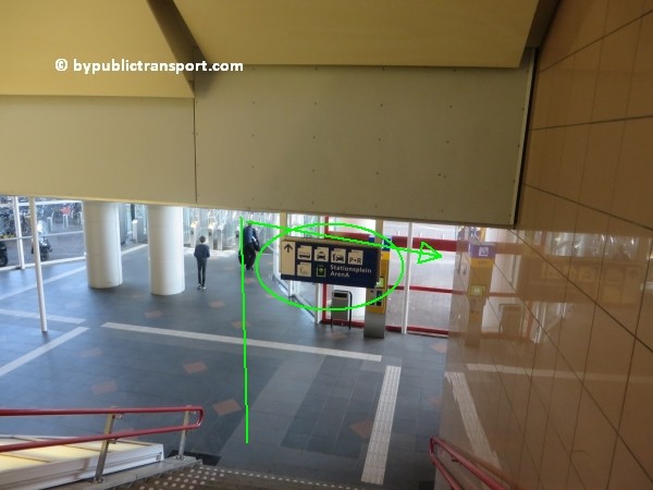
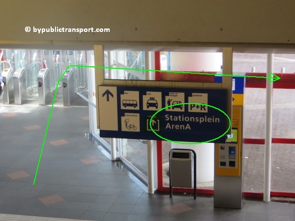
Het station bestaat uit 2 niveaus. Ga helemaal naar beneden en verlaat het station via de trap naar de begane grond. De ArenA staat aangegeven op het blauwe bord onderaan de trap. Zorg dat je uitcheckt bij de juiste vervoerder. Loop bij het verlaten van het station naar rechts.

amsterdam johan cruijff arena met openbaar vervoer by public transport 17

amsterdam johan cruijff arena met openbaar vervoer by public transport 18

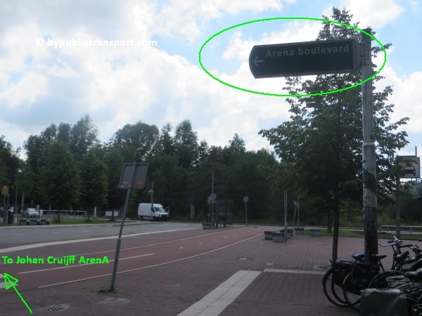
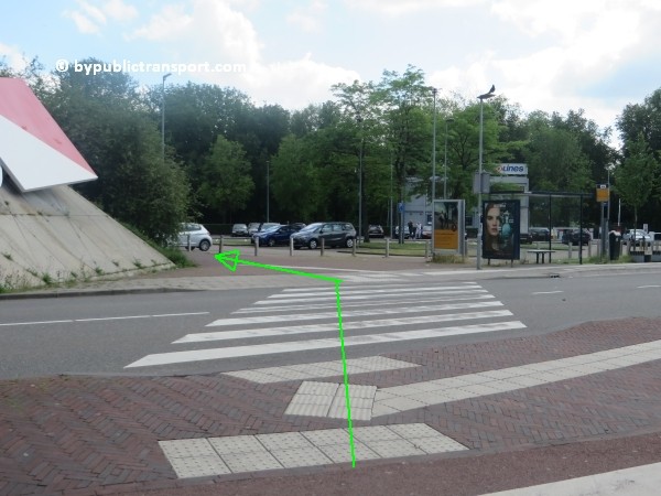
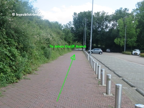
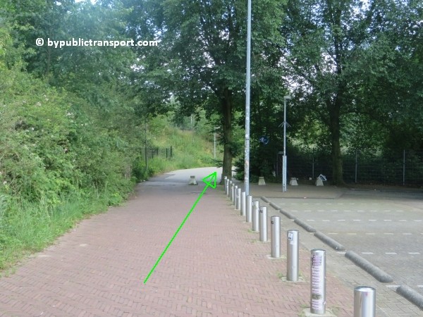
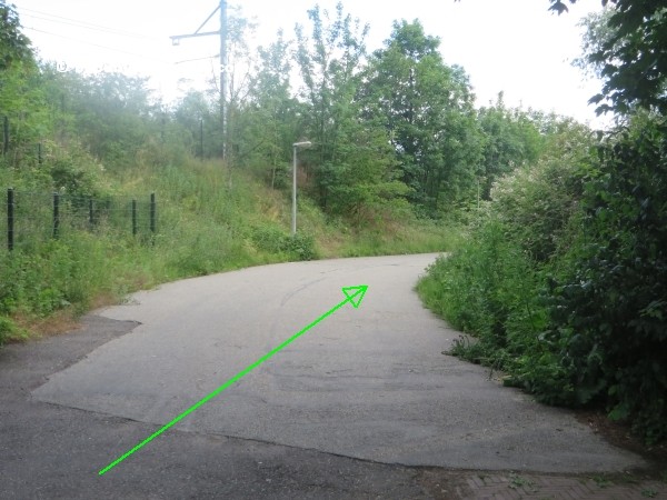
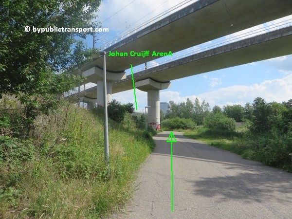
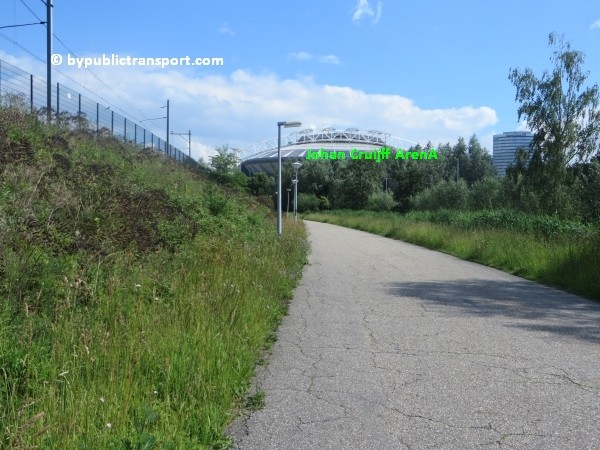
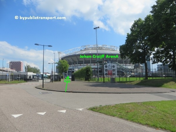
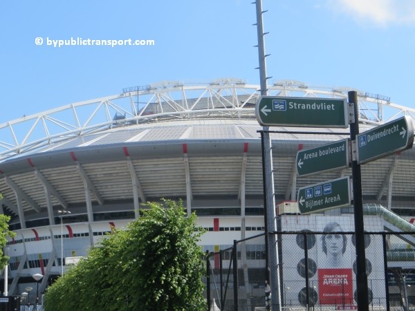
Steek vóór het bord Johan Cruijff Boulevard links het zebrapad over naar de wandelroute, die begint bij de bushalte en het parkeerterrein Q-Park P+R Stationsplein. Loop tussen het parkeerterrein en de spoordijk door. Nu is het een kwestie van de wandelroute volgen tot je de Johan Cruijff ArenA ziet. Je passeert metrostation Strandvliet aan je linkerzijde. Vanaf daar is het nog 3 minuten lopen.

amsterdam johan cruijff arena met openbaar vervoer by public transport 19
amsterdam johan cruijff arena met openbaar vervoer by public transport 20

amsterdam johan cruijff arena met openbaar vervoer by public transport 21

amsterdam johan cruijff arena met openbaar vervoer by public transport 22

amsterdam johan cruijff arena met openbaar vervoer by public transport 23

amsterdam johan cruijff arena met openbaar vervoer by public transport 24

amsterdam johan cruijff arena met openbaar vervoer by public transport 25

amsterdam johan cruijff arena met openbaar vervoer by public transport 26

amsterdam johan cruijff arena met openbaar vervoer by public transport 27

amsterdam johan cruijff arena met openbaar vervoer by public transport 28

Bus

Busstation Bijlmer ArenA is het belangrijkste busstation voor Amsterdam-Zuidoost (Bijlmer). Streeklijnen uit onder andere Utrecht, Haarlem, Aalsmeer, Weesp, Purmerend, Mijdrecht en Almere vinden er hun eindpunt/tussenstop, evenals diverse stadsdiensten en nachtbussen. Het busstation bevindt zich onder de sporen. Je vindt hier onder andere de volgende bussen:

Stadsbus
44 Diemen
47 Gaasperplas – Holendrecht
66 Diemen – IJburg

Streekbus
49 Gaasperplas – Weesp
120 Holendrecht – Abcoude – Breukelen – Maarssen – Utrecht CS
126 Vinkeveen – Wilnis – Mijdrecht
171 Amstelveen – Aalsmeer
202 Muiden – Naarden P+R Gooimeer – Blaricum Tergooi
209 Muiden – Naarden P+R Gooimeer – Blaricum Tergooi – Laren
255 Haarlem

R-net
300 Amstelveen – Schiphol – Hoofddorp- – Haarlem
323 Muiden – Almere Poort – Almere Stad – Almere Parkwijk
328 Muiden – Almere ‘t Oor – Almere Haven
356 Amstelveen – Haarlem

Nachtbus
285 Centraal Station – Rembrandtplein – Amstelstation – Bijlmer ArenA – Holendrecht – Gein
287 Centraal Station – Rembrandtplein – Oost – Diemen – Geinwijk – Bijlmer ArenA
N26 Amsterdam Leidseplein – Bijlmer ArenA – Mijdrecht – Wilnis – Woerden (Nachtversie van lijn 126)
N30 Bijlmer ArenA – Amstelveen – Schiphol – Hoofddorp – Haarlem Station – Driehuis – IJmuiden (Nachtversie van lijn 300)

Laatste update: 10 juli 2022